Size of this preview: 800 × 305 pixels. Other resolutions: 320 × 122 pixels | 1,006 × 383 pixels.
Original file (1,006 × 383 pixels, file size: 823 KB, MIME type: image/jpeg)
| This is a file from the Wikimedia Commons. Information from its description page there is shown below. Commons is a freely licensed media file repository. You can help. |
Summary
| Description |
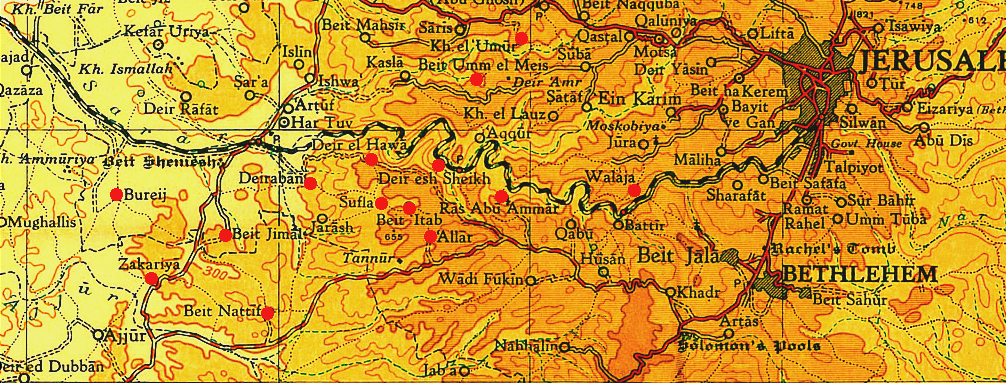
English: Map of the villages captured by Israel soldiers during Operation Ha-Har in October 1948. |
|||
| Date | ||||
| Source | [1] | |||
| Author | Survey of Palestine map (1944) prepared for the 1946 Anglo-American Committee of Enquiry by the British mandatory authorities. Grid = 10km. | |||
| Permission (Reusing this file) |
|

![[1]](http://cs.anu.edu.au/~bdm/yabber/survey1944/SofP2.jpg)
File history
Click on a date/time to view the file as it appeared at that time.
| Date/Time | Thumbnail | Dimensions | User | Comment | |
|---|---|---|---|---|---|
| current | 12:41, 1 August 2013 | 1,006 × 383 (823 KB) | Padres Hana | User created page with UploadWizard |
File usage
The following pages on the English Wikipedia use this file (pages on other projects are not listed):
Global file usage
The following other wikis use this file:
- Usage on ar.wikipedia.org
- Usage on de.wikipedia.org
- Usage on es.wikipedia.org
- Usage on ur.wikipedia.org