No higher resolution available.
Old_Trafford_Cricket_Ground_-_geograph.org.uk_-_2259547.jpg (800 × 510 pixels, file size: 138 KB, MIME type: image/jpeg)
| This is a file from the Wikimedia Commons. Information from its description page there is shown below. Commons is a freely licensed media file repository. You can help. |
Summary
| Description |
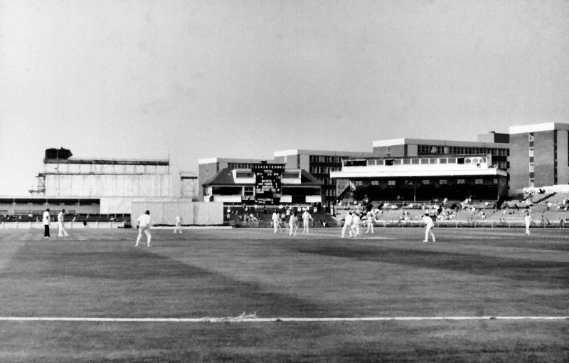
English: Old Trafford Cricket Ground, near to Chorlton-Cum-Hardy, Manchester, Great Britain.
Looking across Old Trafford cricket ground from the Warwick Road end during a match between Lancashire and the Australian Tourists. There have been many developments at the ground since this photograph was taken in 1972 (eg see <a href="https://www.geograph.org.uk/photo/2238526">SJ8195 : Old Trafford Cricket Ground</a>). This year (2011), the square, which currently runs east-west is to be rotated by 90 degrees, so future views will look very different. |
| Date | |
| Source | From geograph.org.uk; transferred by User:BaldBoris using geograph_org2commons. |
| Author | David Dixon |
| Permission (Reusing this file) |
Creative Commons Attribution Share-alike license 2.0 |
| Camera location | | View this and other nearby images on: OpenStreetMap |
|---|
| Object location | | View this and other nearby images on: OpenStreetMap |
|---|
_region:GB-GBN_heading:270.00&language=en)
Licensing

|
This image was taken from the Geograph project collection. See this photograph's page on the Geograph website for the photographer's contact details. The copyright on this image is owned by David Dixon and is licensed for reuse under the Creative Commons Attribution-ShareAlike 2.0 license.
|
This file is licensed under the Creative Commons Attribution-Share Alike 2.0 Generic license.
Attribution: David Dixon
- You are free:
- to share – to copy, distribute and transmit the work
- to remix – to adapt the work
- Under the following conditions:
- attribution – You must give appropriate credit, provide a link to the license, and indicate if changes were made. You may do so in any reasonable manner, but not in any way that suggests the licensor endorses you or your use.
- share alike – If you remix, transform, or build upon the material, you must distribute your contributions under the same or compatible license as the original.
File history
Click on a date/time to view the file as it appeared at that time.
| Date/Time | Thumbnail | Dimensions | User | Comment | |
|---|---|---|---|---|---|
| current | 18:24, 31 March 2011 | | 800 × 510 (138 KB) | File Upload Bot (Magnus Manske) |
File usage
The following pages on the English Wikipedia use this file (pages on other projects are not listed):