
Size of this preview: 800 × 600 pixels. Other resolutions: 320 × 240 pixels | 640 × 480 pixels | 1,024 × 768 pixels | 1,280 × 960 pixels | 2,272 × 1,704 pixels.
Original file (2,272 × 1,704 pixels, file size: 956 KB, MIME type: image/jpeg)
| This is a file from the Wikimedia Commons. Information from its description page there is shown below. Commons is a freely licensed media file repository. You can help. |
Summary
| Description |
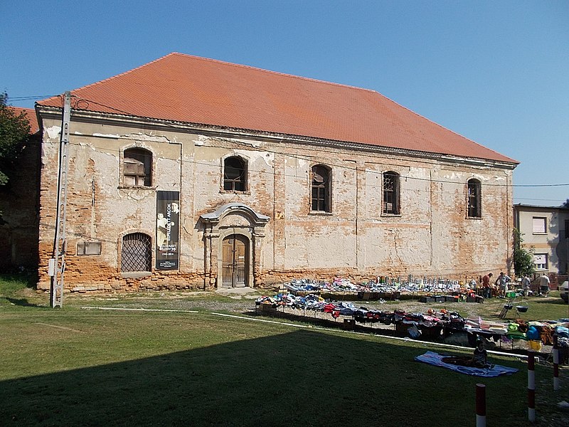
Magyar: : Ózsinagóga, azonosító 8559 (törzsszám 4087). - Egykor zsidók lakta tömb belsejében kialakult téren szabadon álló, téglalap alaprajzú, kontyolt nyeregtetős épület, Ny-i homlokzata előtt emeletes, oromfalas, nyeregtetős lépcsőházzal (a szélein törpepilléres oromfal csúcsán egykor a mózesi kőtáblákkal). A K-i falon oszlopos keretelésű tórafülke, körülötte festett stukkó függöny-baldachin. A tér Ny-i oldalán a női karzat homlokoldalát képező, oszlopos fakarzat, táblás mellvédje fölött gótizáló mellvédráccsal. Az 1764-ben épített, 1794-ben leégett első imaház helyett épült. Átépítve: 1820 és 1896 körül. A női karzatra vezető lépcsőház: 1896 körül, korábbi kőkeretes bejárat és csúcsívdíszű ajtószárnyak újbóli felhasználásával. Az 1980-as években már pusztuló állapotú, magtárként használt épület. . - Tolna megye, Bonyhád, Mártírok tere
|
||||||
| Date | |||||||
| Source | Own work | ||||||
| Author | Globetrotter19 |
Wrong exif date!
Licensing
I, the copyright holder of this work, hereby publish it under the following license:
This file is licensed under the Creative Commons Attribution-Share Alike 3.0 Unported license.
- You are free:
- to share – to copy, distribute and transmit the work
- to remix – to adapt the work
- Under the following conditions:
- attribution – You must give appropriate credit, provide a link to the license, and indicate if changes were made. You may do so in any reasonable manner, but not in any way that suggests the licensor endorses you or your use.
- share alike – If you remix, transform, or build upon the material, you must distribute your contributions under the same or compatible license as the original.
File history
Click on a date/time to view the file as it appeared at that time.
| Date/Time | Thumbnail | Dimensions | User | Comment | |
|---|---|---|---|---|---|
| current | 17:01, 6 March 2017 | | 2,272 × 1,704 (956 KB) | Globetrotter19 | User created page with UploadWizard |
File usage
The following pages on the English Wikipedia use this file (pages on other projects are not listed):
Global file usage
The following other wikis use this file:
- Usage on de.wikipedia.org
- Usage on eo.wikipedia.org
- Usage on hu.wikipedia.org