No higher resolution available.
OR-districts-108.JPG (186 × 151 pixels, file size: 5 KB, MIME type: image/jpeg)
| This is a file from the Wikimedia Commons. Information from its description page there is shown below. Commons is a freely licensed media file repository. You can help. |
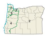
| Description | Image adapted from US fed gov't source nationalatlas.gov en:Category:Oregon maps | |||
| Source | National Atlas of the United States | |||
| Author | United States Department of the Interior | |||
| Permission (Reusing this file) |
|
Original upload log
The original description page was here. All following user names refer to en.wikipedia.
- 2004-02-29 02:15 Seth Ilys 186×151×8 (5367 bytes) {{msg:PD}} Image adapted from US fed gov't source nationalatlas.gov
File history
Click on a date/time to view the file as it appeared at that time.
| Date/Time | Thumbnail | Dimensions | User | Comment | |
|---|---|---|---|---|---|
| current | 17:06, 4 December 2006 | | 186 × 151 (5 KB) | Shyam | {{Information |Description=Image adapted from US fed gov't source nationalatlas.gov en:Category:Oregon maps |Source=Originally from [http://en.wikipedia.org en.wikipedia]; description page is/was [http://en.wikipedia.org/w/index.php?title=Image%3AOR- |
File usage
The following pages on the English Wikipedia use this file (pages on other projects are not listed):
Global file usage
The following other wikis use this file:
- Usage on ca.wikipedia.org
- Usage on de.wikipedia.org
- Usage on es.wikipedia.org
- Usage on fr.wikipedia.org
- Usage on nl.wikipedia.org
- Usage on vi.wikipedia.org