
Size of this PNG preview of this SVG file: 704 × 599 pixels. Other resolutions: 282 × 240 pixels | 564 × 480 pixels | 902 × 768 pixels | 1,203 × 1,024 pixels | 2,405 × 2,048 pixels | 1,400 × 1,192 pixels.
Original file (SVG file, nominally 1,400 × 1,192 pixels, file size: 192 KB)
| This is a file from the Wikimedia Commons. Information from its description page there is shown below. Commons is a freely licensed media file repository. You can help. |
Summary
| Description |
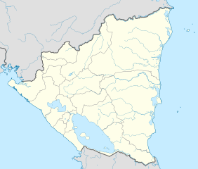
Deutsch: Positionskarte Nicaragua mit Departamentos, Quadratische Plattkarte, N-S-Streckung 100 %. Geographische Begrenzung der Karte:
English: Location map of Nicaragua with Departamentos, Equirectangular projection, N/S stretching 100 %. Geographic limits of the map:
|
| Date | |
| Source | Own work,VMAP0,http://maplibrary.org |
| Author | Alexrk2 |
| Other versions |
Derivative works of this file:
|


|
This map has been made or improved in the German Kartenwerkstatt (Map Lab). You can propose maps to improve as well.
|
Licensing
I, the copyright holder of this work, hereby publish it under the following license:
This file is licensed under the Creative Commons Attribution-Share Alike 3.0 Unported license.
- You are free:
- to share – to copy, distribute and transmit the work
- to remix – to adapt the work
- Under the following conditions:
- attribution – You must give appropriate credit, provide a link to the license, and indicate if changes were made. You may do so in any reasonable manner, but not in any way that suggests the licensor endorses you or your use.
- share alike – If you remix, transform, or build upon the material, you must distribute your contributions under the same or compatible license as the original.
File history
Click on a date/time to view the file as it appeared at that time.
| Date/Time | Thumbnail | Dimensions | User | Comment | |
|---|---|---|---|---|---|
| current | 06:36, 25 May 2021 | | 1,400 × 1,192 (192 KB) | Milenioscuro | corrected some errors |
| 06:30, 25 May 2021 |  | 1,400 × 1,192 (192 KB) | Milenioscuro | corrected department boundaries | |
| 22:09, 17 February 2010 |  | 1,400 × 1,192 (416 KB) | Alexrk2 | - | |
| 20:12, 16 February 2010 |  | 1,400 × 1,192 (415 KB) | Alexrk2 | == Summary == {{Information |Description= {{de|Positionskarte Nicaragua mit Departamentos, Quadratische Plattkarte, N-S-Streckung 100 %. Geographische Begrenzung der Karte:}} {{en|Location map Nicaragua with Departament |
File usage
More than 100 pages use this file. The following list shows the first 100 pages that use this file only. A full list is available.
- Achuapa
- Acoyapa
- Augusto C. Sandino International Airport
- Bluefields
- Boaco
- Catarina, Nicaragua
- Chichigalpa
- Chinandega
- Ciudad Darío
- Ciudad Sandino
- Comalapa, Nicaragua
- Condega
- Corinto, Nicaragua
- Diria
- Diriamba
- Diriomo
- Dolores, Nicaragua
- El Coral
- El Crucero
- El Cuá
- El Jicaral
- El Realejo
- El Rosario, Nicaragua
- El Sauce, Nicaragua
- El Viejo
- Esquipulas, Nicaragua
- Estelí
- Granada, Nicaragua
- Jinotega
- Jinotepe, Carazo
- Juigalpa, Chontales
- La Concepción, Nicaragua
- La Concordia, Nicaragua
- La Conquista, Nicaragua
- La Libertad, Nicaragua
- La Paz Centro
- La Paz de Carazo
- La Trinidad, Nicaragua
- Larreynaga
- Las Sabanas
- León, Nicaragua
- Managua
- Masatepe
- Matagalpa
- Mateare
- Matiguás
- Muy Muy
- Nagarote
- Nandaime
- Nandasmo
- Nindirí, Masaya
- Niquinohomo
- Ocotal
- Ometepe
- Palacagüina
- Pueblo Nuevo, Nicaragua
- Puerto Cabezas
- Puerto Morazán
- Quezalguaque
- Rancho Grande
- Rivas, Nicaragua
- San Carlos, Nicaragua
- San Francisco Libre
- San Francisco de Cuapa
- San Francisco del Norte
- San José de Cusmapa
- San José de los Remates
- San Juan de Limay
- San Juan de Oriente
- San Juan del Río Coco
- San Lorenzo, Nicaragua
- San Lucas, Nicaragua
- San Marcos, Carazo
- San Nicolás, Nicaragua
- San Pedro de Lóvago
- San Pedro del Norte
- San Rafael del Norte
- San Rafael del Sur
- San Sebastián de Yalí
- Santa Lucía, Nicaragua
- Santa María de Pantasma
- Santa Rosa del Peñón
- Santa Teresa, Nicaragua
- Santo Domingo, Nicaragua
- Santo Tomás, Nicaragua
- Santo Tomás del Norte
- Solentiname Islands
- Somotillo
- Somoto, Madriz
- Telica
- Telpaneca
- Teustepe
- Ticuantepe
- Tipitapa
- Tisma
- Totogalpa
- Tuma-La Dalia
- Villa El Carmen
- Villa Sandino
- Villanueva, Chinandega
View more links to this file.
Global file usage
The following other wikis use this file:
- Usage on af.wikipedia.org
- Usage on an.wikipedia.org
- Usage on ar.wikipedia.org
- Usage on ast.wikipedia.org
- Greytown (Nicaragua)
- Managua
- Matiguás
- Muy Muy
- Módulu:Mapa de llocalización/datos/Nicaragua
- Módulu:Mapa de llocalización/datos/Nicaragua/usu
- Aeropuertu Bonanza
- Aeropuertu Punta Huete
- Aeropuertu de Chinandega
- Aeropuertu de Juigalpa
- Aeropuertu de Los Brasiles
- Aeropuertu de Montelimar
- Aeropuertu de Nueva Guinea
- Aeropuertu d'Ometepe
- Aeropuertu de Rosita
- Aeropuertu de San Juan de Nicaragua
- Aeropuertu de Siuna
- Aeropuertu de Waspán
- Aeropuertu internacional Costa Esmeralda
- San Isidro (Nicaragua)
- Usage on ba.wikipedia.org
- Usage on be-tarask.wikipedia.org
- Usage on be.wikipedia.org
- Usage on bg.wikipedia.org
- Usage on bh.wikipedia.org
- Usage on bn.wikipedia.org
View more global usage of this file.