
Size of this preview: 800 × 467 pixels. Other resolutions: 320 × 187 pixels | 640 × 373 pixels | 1,024 × 597 pixels | 1,280 × 747 pixels | 2,560 × 1,493 pixels | 4,588 × 2,676 pixels.
Original file (4,588 × 2,676 pixels, file size: 2.32 MB, MIME type: image/jpeg)
| This is a file from the Wikimedia Commons. Information from its description page there is shown below. Commons is a freely licensed media file repository. You can help. |
Summary
| Description |
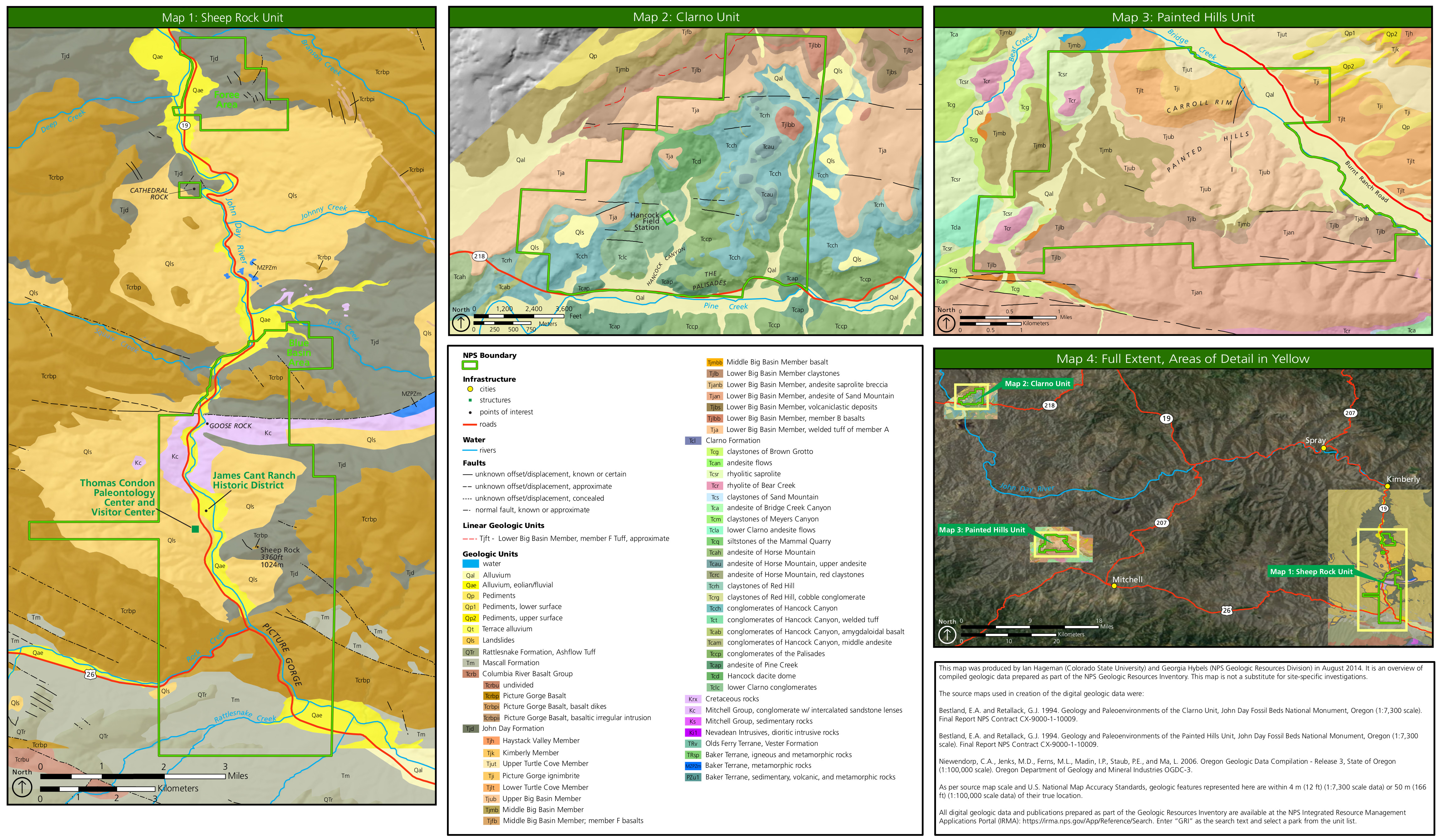
English: This John Day Fossil Beds geologic map is really three maps in one, showing the rock layers and labeling each one in each of the three units of the park: Sheep Rock, Painted Hills, and Clarno. |
| Date | |
| Source | U.S. National Park Service (http://npmaps.com/wp-content/uploads/john-day-fossil-beds-geologic-map.jpg) |
| Author | U.S. National Park Service, restoration/cleanup by Matt Holly |
Licensing
| This image or media file contains material based on a work of a National Park Service employee, created as part of that person's official duties. As a work of the U.S. federal government, such work is in the public domain in the United States. See the NPS website and NPS copyright policy for more information. |
File history
Click on a date/time to view the file as it appeared at that time.
| Date/Time | Thumbnail | Dimensions | User | Comment | |
|---|---|---|---|---|---|
| current | 00:20, 17 May 2017 | | 4,588 × 2,676 (2.32 MB) | RKBot | =={{int:filedesc}}== {{Information |description= {{en|1=This John Day Fossil Beds geologic map is really three maps in one, showing the rock layers and labeling each one in each of the three units of the park: Sheep Rock, Painted Hills, and Clarno.}} |... |
File usage
The following pages on the English Wikipedia use this file (pages on other projects are not listed):