Size of this preview: 659 × 600 pixels. Other resolutions: 264 × 240 pixels | 527 × 480 pixels | 844 × 768 pixels | 1,160 × 1,056 pixels.
Original file (1,160 × 1,056 pixels, file size: 64 KB, MIME type: image/png)
File history
Click on a date/time to view the file as it appeared at that time.
| Date/Time | Thumbnail | Dimensions | User | Comment | |
|---|---|---|---|---|---|
| current | 20:59, 31 March 2016 |  | 1,160 × 1,056 (64 KB) | Fry1989 | Reverted to version as of 20:04, 23 February 2011 (UTC) |
| 22:00, 23 October 2015 |  | 1,160 × 1,056 (63 KB) | Hpyounes | Reverted to version as of 18:32, 26 September 2008 (UTC) | |
| 20:04, 23 February 2011 |  | 1,160 × 1,056 (64 KB) | Omar-Toons | Neutral version for use in the "bilateral relations" Template | |
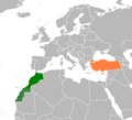
| 18:32, 26 September 2008 |  | 1,160 × 1,056 (63 KB) | Turkish Flame~commonswiki | {{Information |Description=Location of Morocco and Turkey |Source=self-made |Date=26.09.2008 |Author= Turkish Flame |Permission={{GFDL}} |other_versions= }} Category:Maps of Turkey Category:Maps of Morocco [[Category:Bilate |
File usage
The following 2 pages use this file:
Global file usage
The following other wikis use this file:
- Usage on fa.wikipedia.org
- Usage on tr.wikipedia.org
