.jpg)
.jpg&action=edit&redlink=1)
Size of this preview: 714 × 599 pixels. Other resolutions: 286 × 240 pixels | 572 × 480 pixels | 915 × 768 pixels | 1,220 × 1,024 pixels | 1,463 × 1,228 pixels.
Original file (1,463 × 1,228 pixels, file size: 540 KB, MIME type: image/jpeg)
| This is a file from the Wikimedia Commons. Information from its description page there is shown below. Commons is a freely licensed media file repository. You can help. |
.jpg)
Summary
| Description |
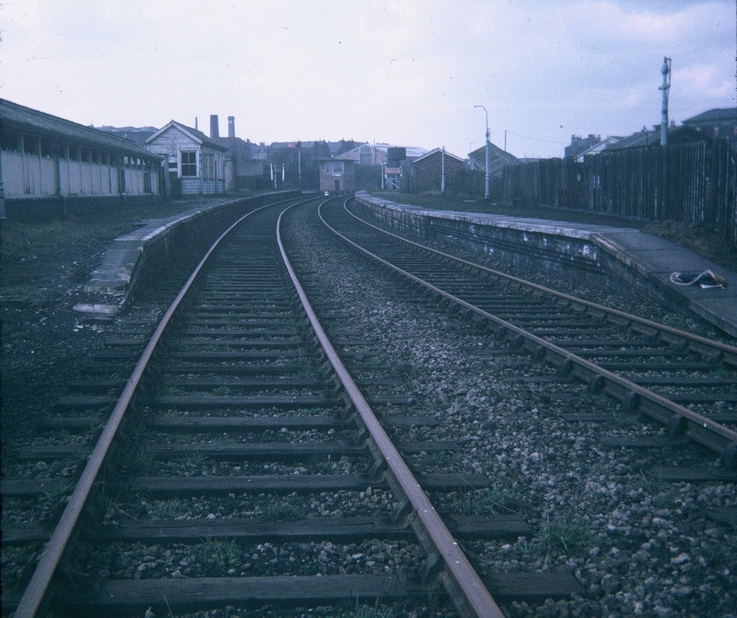
English: Morley Top Station Situated on the former railway line between between Ardsley and Laisterdyke, this station was closed to passengers on the 31st December 1960, and is in quite good condition when photographed eight years later. Closed to goods traffic in May 1969, the station site is now occupied by the B6127 Chartists Way, its postcode being LS27 9ET. Incidentally, the railway line between Leeds and Dewsbury goes through a tunnel underneath this station. |
| Date | |
| Source | From geograph.org.uk |
| Author | David Hillas |
| Permission (Reusing this file) |
Creative Commons Attribution Share-alike license 2.0 |
| Attribution (required by the license) | David Hillas / Morley Top Station / |
| Camera location | | View this and other nearby images on: OpenStreetMap |
|---|
.jpg¶ms=053.741059_N_-001.601372_E_globe:Earth_type:camera_source:geograph-osgb36(SE26392726)_heading:292.00&language=en)
| Object location | | View this and other nearby images on: OpenStreetMap |
|---|
.jpg¶ms=053.741150_N_-001.601670_E_globe:Earth_class:object_type:object_source:geograph-osgb36(SE26372727)_heading:292.00&language=en)
Licensing

|
This image was taken from the Geograph project collection. See this photograph's page on the Geograph website for the photographer's contact details. The copyright on this image is owned by David Hillas and is licensed for reuse under the Creative Commons Attribution-ShareAlike 2.0 license.
|
This file is licensed under the Creative Commons Attribution-Share Alike 2.0 Generic license.
Attribution: David Hillas
- You are free:
- to share – to copy, distribute and transmit the work
- to remix – to adapt the work
- Under the following conditions:
- attribution – You must give appropriate credit, provide a link to the license, and indicate if changes were made. You may do so in any reasonable manner, but not in any way that suggests the licensor endorses you or your use.
- share alike – If you remix, transform, or build upon the material, you must distribute your contributions under the same or compatible license as the original.
File history
Click on a date/time to view the file as it appeared at that time.
| Date/Time | Thumbnail | Dimensions | User | Comment | |
|---|---|---|---|---|---|
| current | 18:52, 11 April 2021 | | 1,463 × 1,228 (540 KB) | Lamberhurst | Transferred from geograph.co.uk using [https://tools.wmflabs.org/geograph2commons/ geograph2commons] |
File usage
The following pages on the English Wikipedia use this file (pages on other projects are not listed):
.jpg)