Size of this preview: 706 × 599 pixels. Other resolutions: 283 × 240 pixels | 566 × 480 pixels | 905 × 768 pixels | 1,137 × 965 pixels.
Original file (1,137 × 965 pixels, file size: 99 KB, MIME type: image/png)
File history
Click on a date/time to view the file as it appeared at that time.
| Date/Time | Thumbnail | Dimensions | User | Comment | |
|---|---|---|---|---|---|
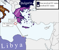
| current | 23:03, 16 June 2023 |  | 1,137 × 965 (99 KB) | Knightoftheswords281 | Adding Cyprus |
| 20:15, 16 June 2023 |  | 1,137 × 965 (99 KB) | Knightoftheswords281 | fixed box | |
| 20:14, 16 June 2023 |  | 1,137 × 965 (99 KB) | Knightoftheswords281 | Removing blue spillover into Turkey | |
| 20:10, 16 June 2023 |  | 1,137 × 965 (99 KB) | Knightoftheswords281 | Blueing borders even more, adding key, and removing EU toponym | |
| 19:48, 16 June 2023 |  | 1,137 × 965 (82 KB) | Knightoftheswords281 | Increased blueness on Greek and Italian borders. | |
| 09:30, 16 June 2023 |  | 1,137 × 965 (91 KB) | Tweedle | quick fix due to incorrect demarcation of 'European Union' over Bulgaria despite the fact that both Greece and Italy are in the EU; the Original creator may want to change the font used on Bulgaria for synchro | |
| 23:35, 15 June 2023 |  | 1,137 × 965 (82 KB) | Knightoftheswords281 | Clarity | |
| 23:27, 15 June 2023 |  | 1,137 × 965 (81 KB) | Knightoftheswords281 | Uploaded own work with UploadWizard |
File usage
The following pages on the English Wikipedia use this file (pages on other projects are not listed):
Global file usage
The following other wikis use this file:
- Usage on ar.wikipedia.org
- Usage on bg.wikipedia.org
- Usage on de.wikipedia.org
- Usage on el.wikipedia.org
- Usage on es.wikipedia.org
- Usage on fi.wikipedia.org
- Usage on fr.wikipedia.org
- Usage on ga.wikipedia.org
- Usage on he.wikipedia.org
- Usage on id.wikipedia.org
- Usage on pnb.wikipedia.org
- Usage on pt.wikipedia.org
- Usage on ru.wikipedia.org
- Usage on uk.wikipedia.org
- Usage on www.wikidata.org
