
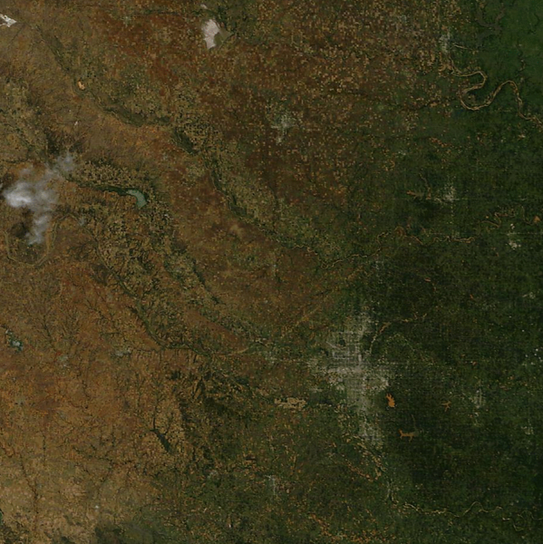
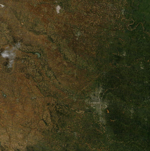
Size of this preview: 599 × 600 pixels. Other resolutions: 240 × 240 pixels | 479 × 480 pixels | 918 × 919 pixels.
Original file (918 × 919 pixels, file size: 1.83 MB, MIME type: image/png)
| This is a file from the Wikimedia Commons. Information from its description page there is shown below. Commons is a freely licensed media file repository. You can help. |
Summary
| Description |
English: May 24, 2011 saw a large severe weather outbreak in Central Oklahoma, including several violent tornadoes. The strongest of these, an EF5 tornado that tracked for 63 miles, left a scar visible from space northwest of Oklahoma City in this May 26 MODIS true-color satellite image, published by the CIMSS Satellite Blog. |
| Date | |
| Source | https://cimss.ssec.wisc.edu/satellite-blog/archives/8237 |
| Author | Scott Bachmeier, MODIS image |
Licensing
| This work has been released into the public domain by its author, CIMSS Satellite Blog. This applies worldwide. In some countries this may not be legally possible; if so: CIMSS Satellite Blog grants anyone the right to use this work for any purpose, without any conditions, unless such conditions are required by law.
|
File history
Click on a date/time to view the file as it appeared at that time.
| Date/Time | Thumbnail | Dimensions | User | Comment | |
|---|---|---|---|---|---|
| current | 19:24, 17 February 2023 | | 918 × 919 (1.83 MB) | Penitentes | Uploaded a work by Scott Bachmeier, MODIS image from https://cimss.ssec.wisc.edu/satellite-blog/archives/8237 with UploadWizard |
File usage
The following pages on the English Wikipedia use this file (pages on other projects are not listed):