Size of this preview: 612 × 600 pixels. Other resolutions: 245 × 240 pixels | 490 × 480 pixels | 857 × 840 pixels.
Original file (857 × 840 pixels, file size: 79 KB, MIME type: image/png)
| This is a file from the Wikimedia Commons. Information from its description page there is shown below. Commons is a freely licensed media file repository. You can help. |
| Description |
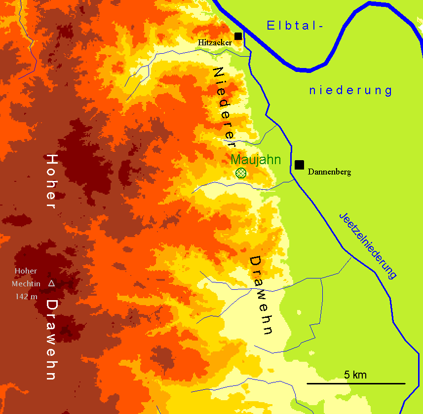
English: Relief map of the location of the "Maujahn" (orange stands e.g. for heights between 50 and 75 mm AMSL, dark red-brown for heights over 100 m).
Deutsch: Karte zur Lage des Erdfallmoores Maujahn mit Hervorhebung von Höhenschichten – geomorphologisches Profil. (Orange steht z. B. für Höhen zwischen 50 und 75 m NN, Dunkel-rotbraun für Höhen über 100 m NN.) |
| Date | (former JPEG version: 2005-05-30) |
| Source | Own work. |
| Author | Christian Fischer |
This file is licensed under the Creative Commons Attribution-Share Alike 3.0 Unported license.
Attribution: Christian Fischer
- You are free:
- to share – to copy, distribute and transmit the work
- to remix – to adapt the work
- Under the following conditions:
- attribution – You must give appropriate credit, provide a link to the license, and indicate if changes were made. You may do so in any reasonable manner, but not in any way that suggests the licensor endorses you or your use.
- share alike – If you remix, transform, or build upon the material, you must distribute your contributions under the same or compatible license as the original.
File history
Click on a date/time to view the file as it appeared at that time.
| Date/Time | Thumbnail | Dimensions | User | Comment | |
|---|---|---|---|---|---|
| current | 14:07, 11 July 2011 | | 857 × 840 (79 KB) | Fice | {{Information |Description= '''''English:''''' Relief map of the location of the "Maujahn" (orange stands e.g. for heights between 50 and 75 mm AMSL, dark red-brown for heights over 100 m). '''''Deutsch:''''' Karte zur Lage des Erdfallmoores [[:de:Mauja |
File usage
The following pages on the English Wikipedia use this file (pages on other projects are not listed):
Global file usage
The following other wikis use this file:
- Usage on de.wikipedia.org
- Usage on www.wikidata.org