_Republica_Centralista.PNG)
_Republica_Centralista.PNG)

Size of this preview: 698 × 600 pixels. Other resolutions: 279 × 240 pixels | 559 × 480 pixels | 894 × 768 pixels | 1,192 × 1,024 pixels | 1,455 × 1,250 pixels.
Original file (1,455 × 1,250 pixels, file size: 93 KB, MIME type: image/png)
| This is a file from the Wikimedia Commons. Information from its description page there is shown below. Commons is a freely licensed media file repository. You can help. |
_Republica_Centralista.PNG)
Summary
| Description |
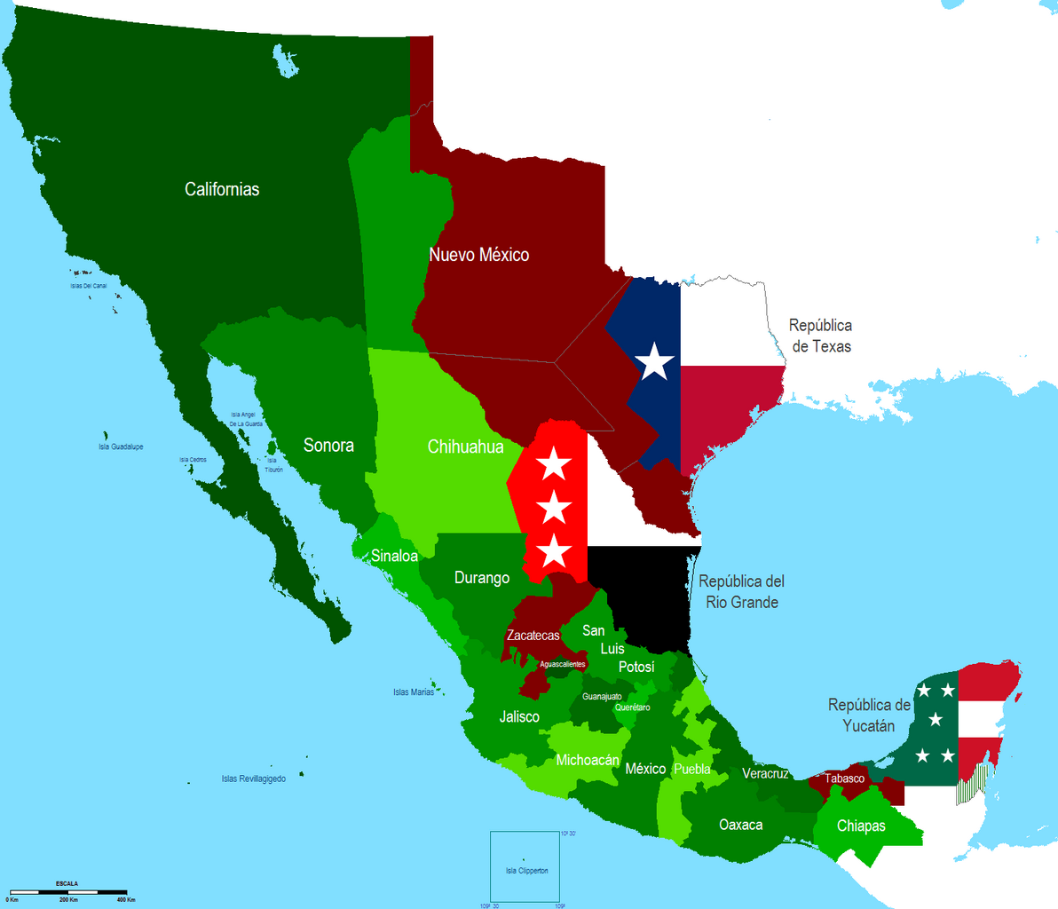
English: Map of the Central Republic (1836-1846) with the changes enacted in the Seven Constitutional Laws and separatist movements generating by the dissolution of the Federation.
Español: Mapa de la República Centralista (1836-1846) con los cambios decretados en las Siete Leyes Constitucionales y los movimientos separatistas que generó la disolución de la Federación. |
| Date | |
| Source | Own work |
| Author | Hpav7 |
Licensing
| I, the copyright holder of this work, release this work into the public domain. This applies worldwide. In some countries this may not be legally possible; if so: I grant anyone the right to use this work for any purpose, without any conditions, unless such conditions are required by law. |
File history
Click on a date/time to view the file as it appeared at that time.
| Date/Time | Thumbnail | Dimensions | User | Comment | |
|---|---|---|---|---|---|
| current | 07:44, 21 September 2011 | | 1,455 × 1,250 (93 KB) | Hpav7 | ajustes |
| 02:30, 2 March 2011 |  | 1,455 × 1,250 (92 KB) | Hpav7 | Cambio de Fronteras | |
| 00:06, 16 January 2010 |  | 1,455 × 1,250 (92 KB) | Hpav7 | {{Information |Description={{en|1=Map of the Central Republic (1836-1846) with the changes enacted in the Seven Constitutional Laws and separatist movements generating by the dissolution of the Federation.}} {{es|1=Mapa de la Republica Centralista (1836-1 |
File usage
The following pages on the English Wikipedia use this file (pages on other projects are not listed):
Global file usage
The following other wikis use this file:
- Usage on es.wikipedia.org
_Republica_Centralista.PNG)