Size of this preview: 800 × 446 pixels. Other resolutions: 320 × 178 pixels | 640 × 357 pixels | 1,024 × 571 pixels | 1,280 × 713 pixels | 2,639 × 1,471 pixels.
Original file (2,639 × 1,471 pixels, file size: 684 KB, MIME type: image/jpeg)
| This is a file from the Wikimedia Commons. Information from its description page there is shown below. Commons is a freely licensed media file repository. You can help. |
Summary
| Description |
English: From
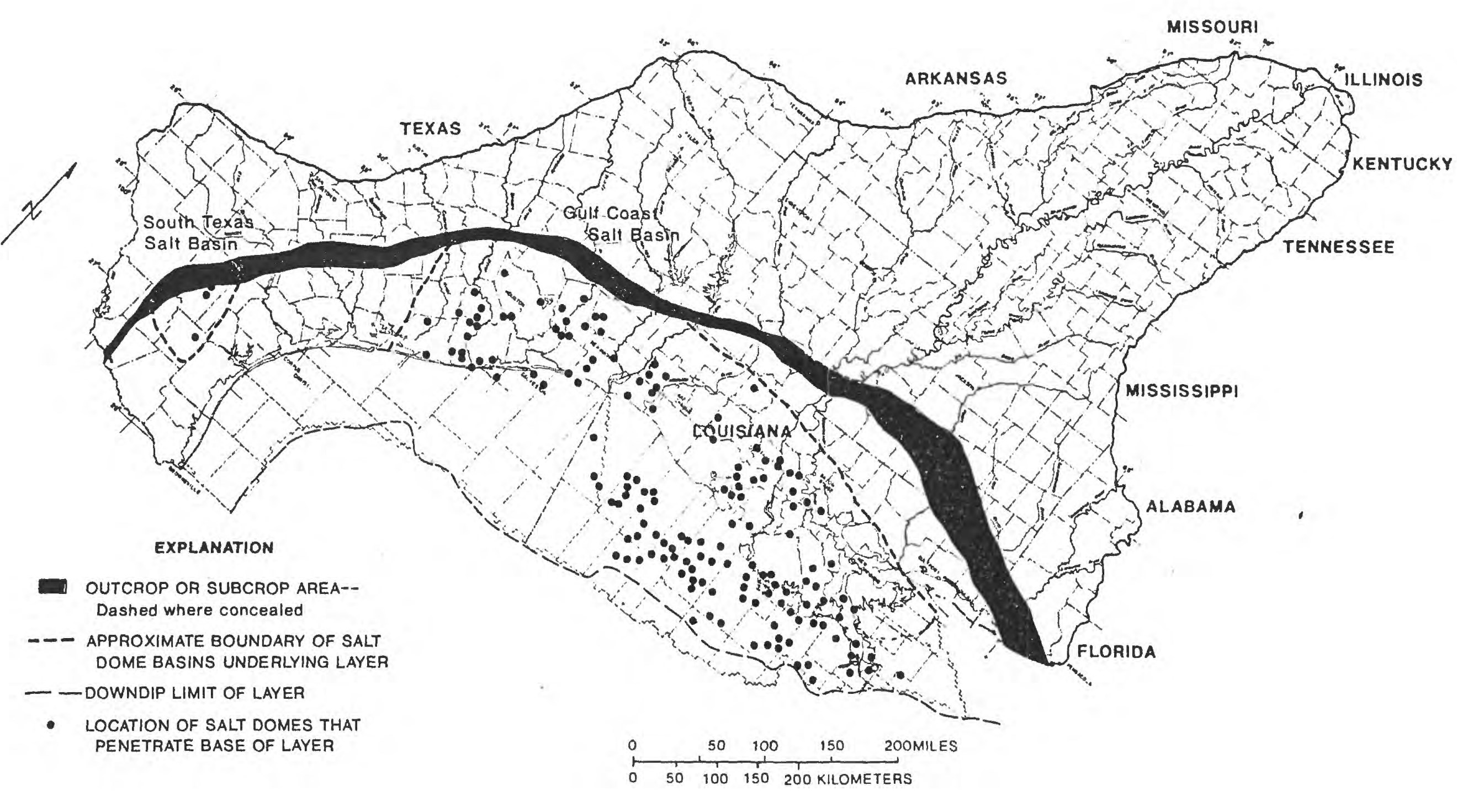
Figure 4. Location of salt domes that penetrate the base of layer 9 (permeable zone C). |
| Date | |
| Source |
SALT-DOME LOCATIONS IN THE GULF COASTAL PLAIN, SOUTH-CENTRAL UNITED STATES Figure 4. Location of salt domes that penetrate the base of layer 9 (permeable zone C). |
| Author |
By Jeffery D. Beckman and Alex K. Williamson U.S. GEOLOGICAL SURVEY WATER-RESOURCES INVESTIGATIONS REPORT 90-4060 A Contribution of the Regional Aquifer-Systems Analysis Program AUSTIN, TEXAS 1990 |
Licensing
This work is in the public domain in the United States because it is a work prepared by an officer or employee of the United States Government as part of that person’s official duties under the terms of Title 17, Chapter 1, Section 105 of the US Code.
Note: This only applies to original works of the Federal Government and not to the work of any individual U.S. state, territory, commonwealth, county, municipality, or any other subdivision. This template also does not apply to postage stamp designs published by the United States Postal Service since 1978. (See § 313.6(C)(1) of Compendium of U.S. Copyright Office Practices). It also does not apply to certain US coins; see The US Mint Terms of Use.
|
 | |
| This file has been identified as being free of known restrictions under copyright law, including all related and neighboring rights. | ||
File history
Click on a date/time to view the file as it appeared at that time.
| Date/Time | Thumbnail | Dimensions | User | Comment | |
|---|---|---|---|---|---|
| current | 19:50, 26 July 2023 | | 2,639 × 1,471 (684 KB) | Cosmia Nebula | Uploaded a work by By Jeffery D. Beckman and Alex K. Williamson U.S. GEOLOGICAL SURVEY WATER-RESOURCES INVESTIGATIONS REPORT 90-4060 A Contribution of the Regional Aquifer-Systems Analysis Program AUSTIN, TEXAS 1990 from SALT-DOME LOCATIONS IN THE GULF COASTAL PLAIN, SOUTH-CENTRAL UNITED STATES Figure 4. Location of salt domes that penetrate the base of layer 9 (permeable zone C). with UploadWizard |
File usage
The following pages on the English Wikipedia use this file (pages on other projects are not listed):