
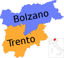
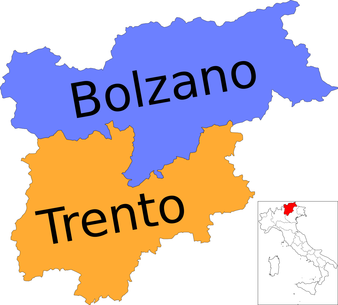
Size of this PNG preview of this SVG file: 665 × 600 pixels. Other resolutions: 266 × 240 pixels | 532 × 480 pixels | 852 × 768 pixels | 1,135 × 1,024 pixels | 2,271 × 2,048 pixels | 3,528 × 3,182 pixels.
Original file (SVG file, nominally 3,528 × 3,182 pixels, file size: 106 KB)
| This is a file from the Wikimedia Commons. Information from its description page there is shown below. Commons is a freely licensed media file repository. You can help. |
Summary
| Description | (Italian version) |
| Date | |
| Source | Own work |
| Author | Vonvikken |
| Other versions |
      |
This W3C-unspecified vector image was created with Inkscape .
W3C-validity not checked.

|
This SVG file contains embedded text that can be translated into your language, using any capable SVG editor, text editor or the SVG Translate tool. For more information see: About translating SVG files. |
This vector image includes elements that have been taken or adapted from this file:
This vector image includes elements that have been taken or adapted from this file:
Licensing
| This work has been released into the public domain by its author, Vonvikken. This applies worldwide. In some countries this may not be legally possible; if so: |
File history
Click on a date/time to view the file as it appeared at that time.
| Date/Time | Thumbnail | Dimensions | User | Comment | |
|---|---|---|---|---|---|
| current | 22:37, 3 December 2010 | | 3,528 × 3,182 (106 KB) | Vonvikken | == {{int:filedesc}} == {{Information |Description={{DescrMapRegionItaly|TRE|Italian}} |Source={{own}} |Author=Vonvikken |Date=2010-12-03 |Permission= |other_versions=100px|Blank[ |
File usage
The following pages on the English Wikipedia use this file (pages on other projects are not listed):
Global file usage
The following other wikis use this file:
- Usage on ar.wikipedia.org
- Usage on bg.wikipedia.org
- Usage on cs.wikipedia.org
- Usage on cy.wikipedia.org
- Usage on da.wikipedia.org
- Usage on et.wikipedia.org
- Usage on hu.wikipedia.org
- Usage on it.wikipedia.org
- Usage on it.wikinews.org
- Usage on lmo.wikipedia.org
- Usage on nl.wikipedia.org
- Usage on os.wikipedia.org
- Usage on pt.wikipedia.org
- Usage on sq.wikipedia.org
- Usage on sv.wikipedia.org
- Usage on uz.wikipedia.org
- Usage on vls.wikipedia.org