
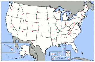
Size of this preview: 800 × 525 pixels. Other resolutions: 320 × 210 pixels | 640 × 420 pixels | 904 × 593 pixels.
Original file (904 × 593 pixels, file size: 41 KB, MIME type: image/png)
| This is a file from the Wikimedia Commons. Information from its description page there is shown below. Commons is a freely licensed media file repository. You can help. |
Summary
| Description |
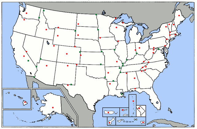
English: A map of the high points of the U.S. states and territories (red dots) and lowest points (green dots). The 5 major U.S. territories and the District of Columbia are in insets. The U.S. Minor Outlying Islands are not on the map. If the lowest point of a state or territory is an ocean, one of the Great Lakes, or Lake Champlain, there is no green dot. Map is a modified version of the map at this URL: https://commons.wikimedia.org/wiki/File:Map_of_USA_elevations.png |
| Date | |
| Source | This is a modified version of a map already on Wikimedia Commons at this URL: https://commons.wikimedia.org/wiki/File:Map_of_USA_elevations.png |
| Author | ChristopherM at English Wikipedia |
Licensing
This file is licensed under the Creative Commons Attribution-Share Alike 3.0 Unported license.
- You are free:
- to share – to copy, distribute and transmit the work
- to remix – to adapt the work
- Under the following conditions:
- attribution – You must give appropriate credit, provide a link to the license, and indicate if changes were made. You may do so in any reasonable manner, but not in any way that suggests the licensor endorses you or your use.
- share alike – If you remix, transform, or build upon the material, you must distribute your contributions under the same or compatible license as the original.
File history
Click on a date/time to view the file as it appeared at that time.
| Date/Time | Thumbnail | Dimensions | User | Comment | |
|---|---|---|---|---|---|
| current | 16:01, 29 August 2019 | | 904 × 593 (41 KB) | LumaP15 | User created page with UploadWizard |
File usage
The following pages on the English Wikipedia use this file (pages on other projects are not listed):