
Size of this preview: 389 × 599 pixels. Other resolutions: 156 × 240 pixels | 312 × 480 pixels | 499 × 768 pixels | 665 × 1,024 pixels | 2,055 × 3,163 pixels.
Original file (2,055 × 3,163 pixels, file size: 2.19 MB, MIME type: image/jpeg)
| This is a file from the Wikimedia Commons. Information from its description page there is shown below. Commons is a freely licensed media file repository. You can help. |
Summary
| Description |
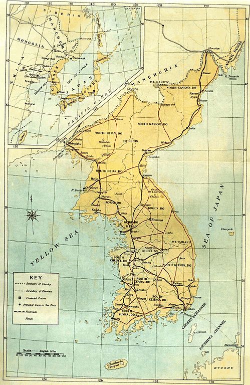
English: Old map of Korean peninsula with Japanese names.
한국어: 일제 강점기 한반도의 지도.
Русский: Старая карта Корейского полуострова с японскими названиями. |
| Date | |
| Source | Book "Chosen of Today" |
| Author | The Government-General of Korea |
Licensing
|
This work is in the public domain in its country of origin and other countries and areas where the copyright term is the author's life plus 70 years or fewer. | |
| This file has been identified as being free of known restrictions under copyright law, including all related and neighboring rights. | |
File history
Click on a date/time to view the file as it appeared at that time.
| Date/Time | Thumbnail | Dimensions | User | Comment | |
|---|---|---|---|---|---|
| current | 18:36, 19 March 2010 | | 2,055 × 3,163 (2.19 MB) | Vajotwo | Removed borders |
| 15:02, 7 January 2010 |  | 2,315 × 3,263 (3.09 MB) | Elmor | {{Information |Description={{en|1=Old map of Korean peninsula with Japanese names.}} {{ko|1=일제시대 한바도의 지도.}} {{ru|1=Старая карта Корейского полуострова с японскими названиями.}} |Sourc |
File usage
No pages on the English Wikipedia use this file (pages on other projects are not listed).
Global file usage
The following other wikis use this file:
- Usage on da.wikipedia.org
- Usage on da.wikibooks.org
- Usage on de.wikipedia.org
- Usage on fr.wikipedia.org
- Usage on kk.wikipedia.org
- Usage on lv.wikipedia.org
- Usage on no.wikipedia.org
- Usage on ru.wikipedia.org
- Usage on sv.wikipedia.org
- Usage on tr.wikipedia.org
- Usage on uz.wikipedia.org
- Usage on zh-yue.wikipedia.org