
Size of this PNG preview of this SVG file: 800 × 414 pixels. Other resolutions: 320 × 166 pixels | 640 × 331 pixels | 1,024 × 530 pixels | 1,280 × 663 pixels | 2,560 × 1,326 pixels | 2,192 × 1,135 pixels.
Original file (SVG file, nominally 2,192 × 1,135 pixels, file size: 1.64 MB)
| This is a file from the Wikimedia Commons. Information from its description page there is shown below. Commons is a freely licensed media file repository. You can help. |
Summary
| Description |
Afrikaans: Kaart van BRICS-lande
Deutsch: Karte der BRICS-Staaten
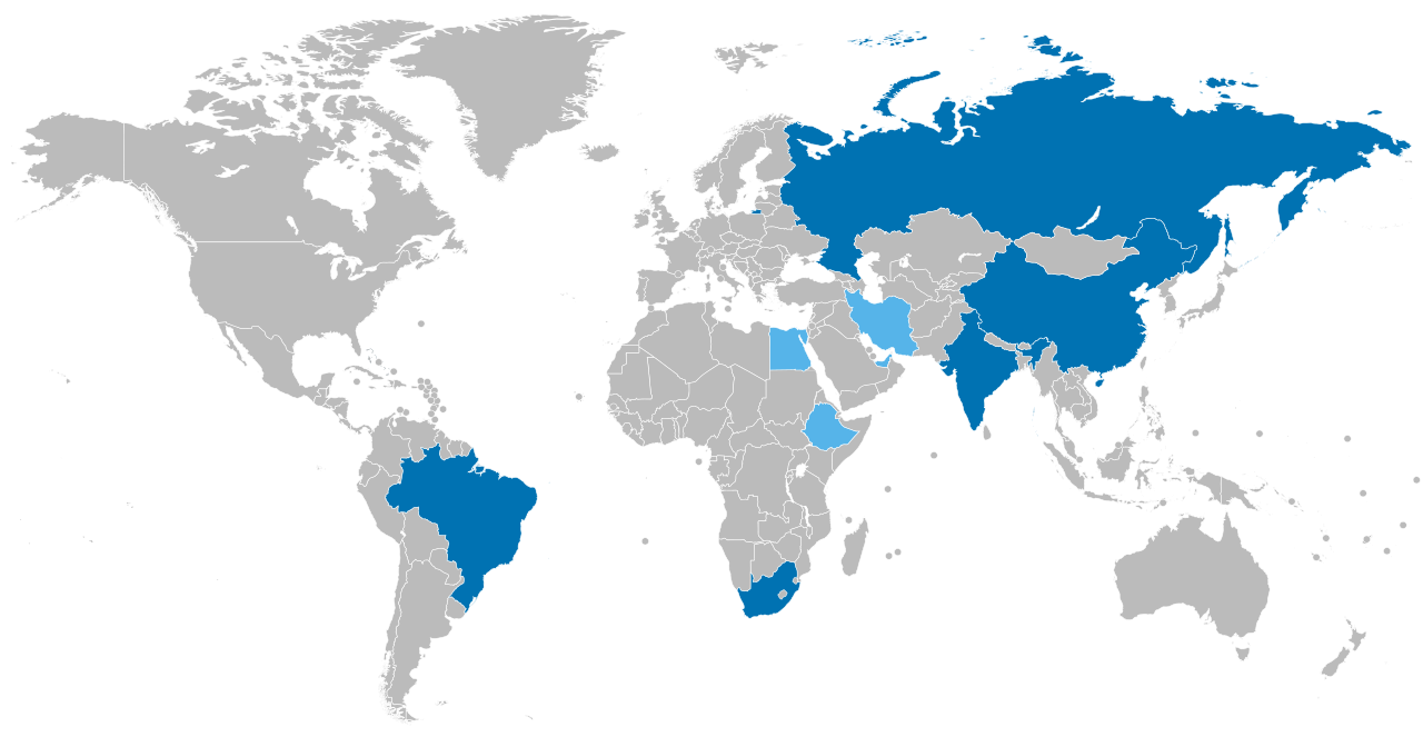
English: Map of BRICS countries
Español: Mapa de los países BRICS
Français : Carte des pays BRICS
Português: Mapa dos países BRICS
Русский: Карта стран БРИКС
हिन्दी: ब्रिक्स देशों का मानचित्र
中文:金磚國家地圖
العربية: خريطة دول البريكس
Українська: Мапа країн БРІКС |
| Date | |
| Source | Own work |
| Author | Дмитрий-5-Аверин |
| Other versions |
|


This image belongs in a set with this other image.
Public Domain alternative
A similar version of this map exist in the public domain. It has a different projection and Antarctica.
Licensing
I, the copyright holder of this work, hereby publish it under the following license:
This file is licensed under the Creative Commons Attribution-Share Alike 3.0 Unported license.
- You are free:
- to share – to copy, distribute and transmit the work
- to remix – to adapt the work
- Under the following conditions:
- attribution – You must give appropriate credit, provide a link to the license, and indicate if changes were made. You may do so in any reasonable manner, but not in any way that suggests the licensor endorses you or your use.
- share alike – If you remix, transform, or build upon the material, you must distribute your contributions under the same or compatible license as the original.
File history
Click on a date/time to view the file as it appeared at that time.
| Date/Time | Thumbnail | Dimensions | User | Comment | |
|---|---|---|---|---|---|
| current | 09:33, 19 January 2024 | | 2,192 × 1,135 (1.64 MB) | Sangjinhwa | - Saudi Arabia |
| 20:34, 29 December 2023 |  | 2,192 × 1,135 (1.64 MB) | NordNordWest | - Argentina, https://www.bbc.com/news/world-latin-america-67842992 | |
| 22:51, 20 September 2023 |  | 2,192 × 1,135 (1.64 MB) | Mathsquare | Tiny triangle of Qatar was green for some reason. | |
| 09:38, 28 August 2023 |  | 2,192 × 1,135 (1.59 MB) | M.Bitton | Reverted to version as of 17:00, 26 August 2023 (UTC): per COM:OVERWRITE, you're not supposed to change the borders | |
| 08:24, 28 August 2023 |  | 2,756 × 1,399 (822 KB) | Peter Njeim | Switched to Robinson projection. Colors have enough lightness difference to be accessible to colorblind individuals | |
| 17:00, 26 August 2023 |  | 2,192 × 1,135 (1.59 MB) | Mathsquare | Updated within our guidelines for accessibility for people who has a form of a color deficiency. And to use the same platte of https://upload.wikimedia.org/wikipedia/commons/9/9a/Map_of_BRICS_countries_interested.svg - https://en.wikipedia.org/wiki/Help:Using_colours https://commons.wikimedia.org/wiki/Commons:Creating_accessible_illustrations | |
| 13:09, 25 August 2023 |  | 2,192 × 1,135 (1.64 MB) | Allice Hunter | Adding the UAE | |
| 03:26, 25 August 2023 |  | 2,192 × 1,135 (1.64 MB) | Allice Hunter | Applicant members from 2024 on | |
| 00:44, 27 April 2023 |  | 2,192 × 1,135 (1.64 MB) | Allice Hunter | If there was a problem for you so it's solved | |
| 00:41, 27 April 2023 |  | 2,192 × 1,135 (1.64 MB) | Allice Hunter | Reverted to version as of 01:58, 22 April 2023 (UTC) Was that even serious? |
File usage
The following pages on the English Wikipedia use this file (pages on other projects are not listed):
Global file usage
The following other wikis use this file:
- Usage on af.wikipedia.org
- Usage on ast.wikipedia.org
- Usage on az.wikipedia.org
- Usage on ba.wikipedia.org
- Usage on ckb.wikipedia.org
- Usage on cv.wikipedia.org
- Usage on es.wikipedia.org
- Usage on es.wikinews.org
- Usage on et.wikipedia.org
- Usage on hy.wikipedia.org
- Usage on id.wikipedia.org
- Usage on km.wikipedia.org
- Usage on ko.wikipedia.org
- Usage on ml.wikipedia.org
- Usage on pa.wikipedia.org
- Usage on ru.wiktionary.org
- Usage on sl.wikipedia.org
- Usage on ta.wikipedia.org
- Usage on tr.wikipedia.org
- Usage on tt.wikipedia.org
- Usage on uk.wikipedia.org