.png)
.png&action=edit&redlink=1)
Size of this preview: 755 × 600 pixels. Other resolutions: 302 × 240 pixels | 605 × 480 pixels | 821 × 652 pixels.
Original file (821 × 652 pixels, file size: 160 KB, MIME type: image/png)
| This is a file from the Wikimedia Commons. Information from its description page there is shown below. Commons is a freely licensed media file repository. You can help. |
.png)
Summary
| Description |
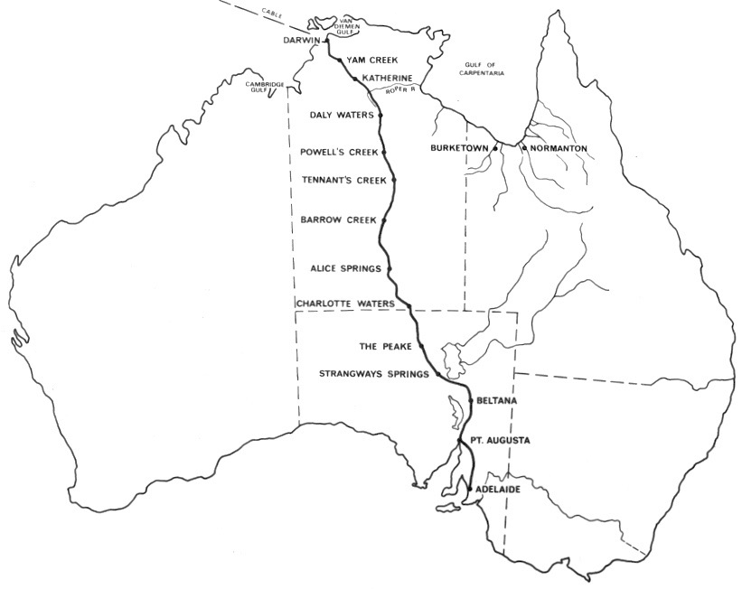
English: Map of Australia's Overland Telegraph Line completed in 1872 |
| Date | circa 1940 |
| Source | State Library of South Australia — https://collections.slsa.sa.gov.au/resource/B+78437 |
| Author | Telecom Australia |
Licensing
This file is in the public domain because the State Library of South Australia website (see "Source"), from which the image file was downloaded, states that the photograph has no known copyright restrictions.
|
This work is in the public domain in the United States because it meets three requirements:
For background information, see the explanations on Non-U.S. copyrights.
Note: This tag should not be used for sound recordings. |
↑ The public domain status of this image in Australia and the United States satisfies the requirements of Wikimedia Commons licensing policy.
File history
Click on a date/time to view the file as it appeared at that time.
| Date/Time | Thumbnail | Dimensions | User | Comment | |
|---|---|---|---|---|---|
| current | 07:32, 21 August 2022 | | 821 × 652 (160 KB) | SCHolar44 | Uploaded a work by Telecom Australia from State Library of South Australia — https://collections.slsa.sa.gov.au/resource/B+78437 with UploadWizard |
File usage
The following pages on the English Wikipedia use this file (pages on other projects are not listed):
Global file usage
The following other wikis use this file:
- Usage on de.wikipedia.org
.png)