
Size of this PNG preview of this SVG file: 700 × 599 pixels. Other resolutions: 280 × 240 pixels | 561 × 480 pixels | 897 × 768 pixels | 1,196 × 1,024 pixels | 2,392 × 2,048 pixels | 1,035 × 886 pixels.
Original file (SVG file, nominally 1,035 × 886 pixels, file size: 189 KB)
| This is a file from the Wikimedia Commons. Information from its description page there is shown below. Commons is a freely licensed media file repository. You can help. |
Summary
| Description |
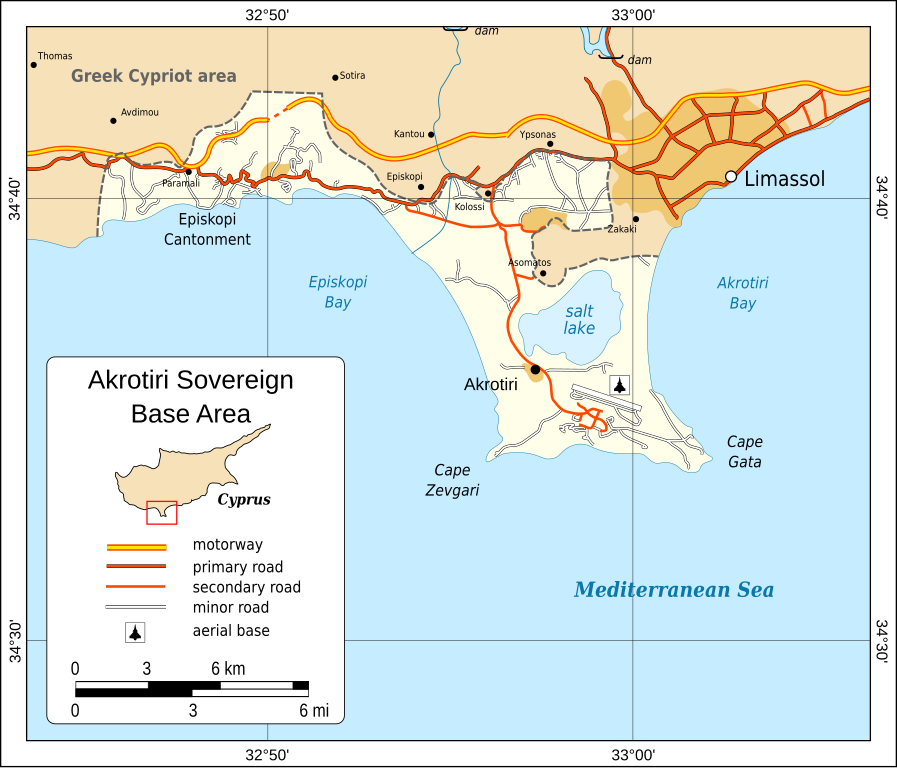
English: Map of the Akrotiri Sovereign Base Area in Cyprus. |
| Date | |
| Source | Self-made in Inkscape. Borders based on CIA World Factbook. Some map data (roads) © OpenStreetMap contributors, CC-BY-SA. |
| Author | Oona Räisänen |
| Other versions |
|


Licensing
I, the copyright holder of this work, hereby publish it under the following license:
This file is licensed under the Creative Commons Attribution-Share Alike 3.0 Unported license.
- You are free:
- to share – to copy, distribute and transmit the work
- to remix – to adapt the work
- Under the following conditions:
- attribution – You must give appropriate credit, provide a link to the license, and indicate if changes were made. You may do so in any reasonable manner, but not in any way that suggests the licensor endorses you or your use.
- share alike – If you remix, transform, or build upon the material, you must distribute your contributions under the same or compatible license as the original.
File history
Click on a date/time to view the file as it appeared at that time.
| Date/Time | Thumbnail | Dimensions | User | Comment | |
|---|---|---|---|---|---|
| current | 09:39, 10 June 2010 | | 1,035 × 886 (189 KB) | Mysid | font change |
| 09:36, 10 June 2010 |  | 1,035 × 886 (189 KB) | Mysid | {{Information |Description={{en|1=Map of the Akrotiri Sovereign Base Area in Cyprus.}} |Source=Self-made in Inkscape. Borders based on CIA World Factbook. Some map data (roads) © OpenStreetMap contributors, CC-BY-SA. |Author=Mysid |Date= |
File usage
The following pages on the English Wikipedia use this file (pages on other projects are not listed):
Global file usage
The following other wikis use this file:
- Usage on cs.wikipedia.org
- Usage on fr.wikipedia.org
- Usage on ja.wikipedia.org
- Usage on ko.wikipedia.org
- Usage on nl.wikipedia.org
- Usage on no.wikipedia.org
- Usage on pt.wikipedia.org
- Usage on ru.wikipedia.org
- Usage on uk.wikipedia.org
- Usage on zh.wikipedia.org