No higher resolution available.
Map_Whitehouse_Ward,_Ipswich.png (243 × 313 pixels, file size: 128 KB, MIME type: image/png)
| This is a file from the Wikimedia Commons. Information from its description page there is shown below. Commons is a freely licensed media file repository. You can help. |
Summary
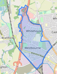
| Description |
English: Open Street Map with area shaded blue for Whitehouse Ward, Ipswich |
| Date | |
| Source | https://mapit.mysociety.org/area/47320.html |
| Author | Open Street Map contributors |
Licensing
| Description |
This map of North West Ipswich was created from OpenStreetMap project data, collected by the community. This map may be incomplete, and may contain errors. Don't rely solely on it for navigation. |
|||
| Date | (see file history) | |||
| Source | You may find a page on the OpenStreetMap wiki page for Map of Whitehouse Ward, Ipswich OSM 2018.02.16 | |||
| Creator |
Open Street Map contributors taken from MapItUK] OpenStreetMap contributors |
|||
| Permission (Reusing this file) |
OpenStreetMap data is available under the Open Database License (details). Standard style map tiles are licensed as ODbL Produced Works.
|
|||
| Georeferencing | If inappropriate please set warp_status = skip to hide. |
File history
Click on a date/time to view the file as it appeared at that time.
| Date/Time | Thumbnail | Dimensions | User | Comment | |
|---|---|---|---|---|---|
| current | 10:32, 12 June 2020 | | 243 × 313 (128 KB) | Leutha | Uploaded a work by Open Street Map contributors from https://mapit.mysociety.org/area/47320.html with UploadWizard |
File usage
The following pages on the English Wikipedia use this file (pages on other projects are not listed):
Global file usage
The following other wikis use this file:
- Usage on www.wikidata.org