
Size of this PNG preview of this SVG file: 645 × 600 pixels. Other resolutions: 258 × 240 pixels | 516 × 480 pixels | 826 × 768 pixels | 1,101 × 1,024 pixels | 2,202 × 2,048 pixels | 773 × 719 pixels.
Original file (SVG file, nominally 773 × 719 pixels, file size: 294 KB)
| This is a file from the Wikimedia Commons. Information from its description page there is shown below. Commons is a freely licensed media file repository. You can help. |
Summary
| Description |
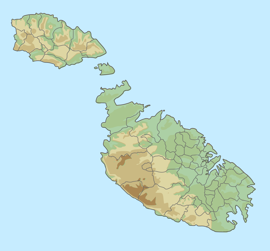
English: location map for Malta
Equirectangular projection. Geographic limits of the map:
|
| Date | |
| Source |
Malta_location_map.svg General_map_of_Malta.svg |
| Author |
Chumwa Trex Bjankuloski06en |
Licensing
This file is licensed under the Creative Commons Attribution-Share Alike 3.0 Unported license.
- You are free:
- to share – to copy, distribute and transmit the work
- to remix – to adapt the work
- Under the following conditions:
- attribution – You must give appropriate credit, provide a link to the license, and indicate if changes were made. You may do so in any reasonable manner, but not in any way that suggests the licensor endorses you or your use.
- share alike – If you remix, transform, or build upon the material, you must distribute your contributions under the same or compatible license as the original.
File history
Click on a date/time to view the file as it appeared at that time.
| Date/Time | Thumbnail | Dimensions | User | Comment | |
|---|---|---|---|---|---|
| current | 12:39, 6 August 2015 | | 773 × 719 (294 KB) | Xfigpower | User created page with UploadWizard |
File usage
The following pages on the English Wikipedia use this file (pages on other projects are not listed):
Global file usage
The following other wikis use this file:
- Usage on hu.wikipedia.org
- Usage on it.wikipedia.org
- Usage on oc.wikipedia.org
- Usage on pl.wikipedia.org
- Malta (wyspa)
- Gozo
- Comino
- Oblężenie Malty (1565)
- Malta
- Cominotto
- Filfla
- Azure Window
- Ramla Bay
- Wyspy Świętego Pawła (Malta)
- Bitwa morska koło Malty
- Ta’ Dmejrek
- Oblężenie Malty (1940–1942)
- Park Narodowy Ta’ Qali
- Geografia Malty
- Fungus Rock
- Inland Sea
- Wielki Port
- Transport na Malcie
- Plaże na Malcie
- Ġebel San Pietru
- Wyspa Manoela
- Wikipedysta:Pygar1954/brudnopis6
- Moduł:Mapa/dane/Malta
- Moduł:Mapa/dane/MLT
- Bunt Regimentu Froberga
- Port Marsamxett
- Oblężenie Malty (1429)
- Ġebel Ċantar
- Tal-Merħla
- Ta’ Dbieġi
- Ta’ Dabrani
- Ta’ Kuljat
- Tas-Salvatur
- Is-Simar
- Oblężenie Malty (1798–1800)
- Halfa Rock
- Is-Salini
- Wzgórza Malty
- Wikipedysta:Subtropical-man/brudnopis2
- Bitwa konwoju maltańskiego (1800)
- Wikipedysta:Subtropical-man/brudnopis3
- Mġarr ix-Xini
- Blue Hole (Gozo)
View more global usage of this file.