File:Luftwaffe High Frequency Direction Finding (DF) operations before D-Day, World War II.svg
_operations_before_D-Day,_World_War_II.svg)
_operations_before_D-Day,_World_War_II.svg&action=edit&redlink=1)

Size of this PNG preview of this SVG file: 751 × 600 pixels. Other resolutions: 301 × 240 pixels | 601 × 480 pixels | 962 × 768 pixels | 1,280 × 1,022 pixels | 2,560 × 2,044 pixels | 1,251 × 999 pixels.
Original file (SVG file, nominally 1,251 × 999 pixels, file size: 510 KB)
| This is a file from the Wikimedia Commons. Information from its description page there is shown below. Commons is a freely licensed media file repository. You can help. |
_operations_before_D-Day,_World_War_II.svg)
Summary
| Description |
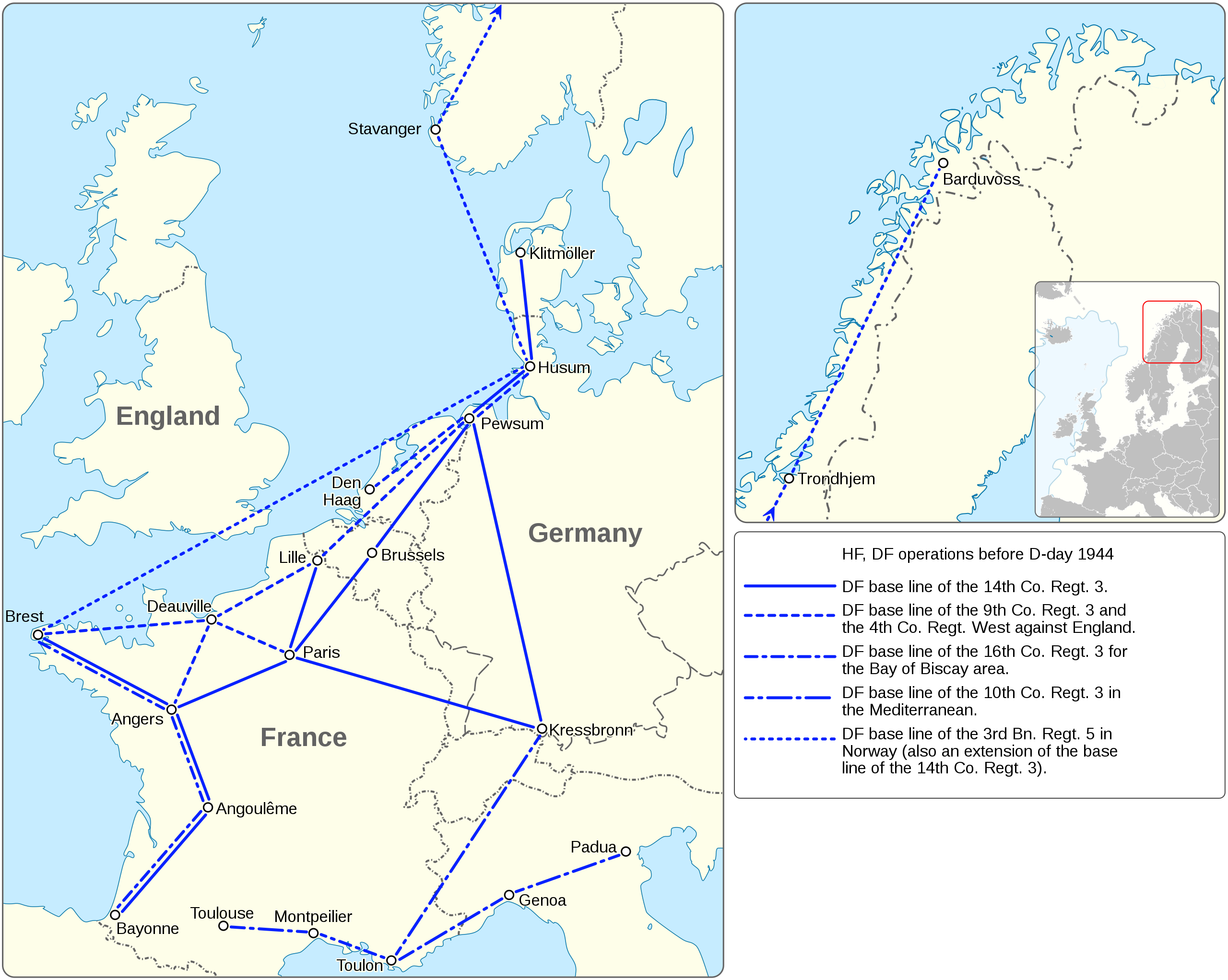
English: This diagram represents a number of Direction-Finding (DF) base lines that were created by the Luftwaffe, and in place before D-Day. DF baselines are imaginary lines or axis in which DF equipment of a DF network is deployed in locations on that line. Luftwaffe Signals used straight DF lines. The length of the base line indicated the net location capability value in miles, in which a DF location can be made. For example, the distance from Husum, Germany to Brest France is 716 miles, meaning that the net location capability is 716 miles in depth. IF-181 Seabourne Report Vol VI Pt.2 p.47a |
| Date | |
| Source |
Own work Information from: |
| Author | Goran tek-en, following request by Scope creep |
| Permission (Reusing this file) |
This file is licensed under the Creative Commons Attribution-Share Alike 4.0 International license. Attribution: Goran tek-en
|
| SVG development |
File history
Click on a date/time to view the file as it appeared at that time.
| Date/Time | Thumbnail | Dimensions | User | Comment | |
|---|---|---|---|---|---|
| current | 17:56, 13 December 2018 | | 1,251 × 999 (510 KB) | Goran tek-en | {{Information |description ={{en|1=This diagram represents a number of Direction-Finding (DF) base lines that were created by the Luftwaffe, and in place before D-Day. DF baselines are imaginary lines or axis in which DF equipment of a DF network is deployed in locations on that line. Luftwaffe Signals used straight DF lines. The length of the base line indicated the net location capability value in miles, in which a DF location can be made. For example, the distance from Husum, Germany t... |
File usage
The following pages on the English Wikipedia use this file (pages on other projects are not listed):
_operations_before_D-Day,_World_War_II.svg)