Size of this preview: 800 × 600 pixels. Other resolutions: 320 × 240 pixels | 640 × 480 pixels | 1,024 × 768 pixels | 1,280 × 960 pixels | 2,560 × 1,920 pixels | 4,608 × 3,456 pixels.
Original file (4,608 × 3,456 pixels, file size: 2.77 MB, MIME type: image/jpeg)
| This is a file from the Wikimedia Commons. Information from its description page there is shown below. Commons is a freely licensed media file repository. You can help. |
Summary
| Description |
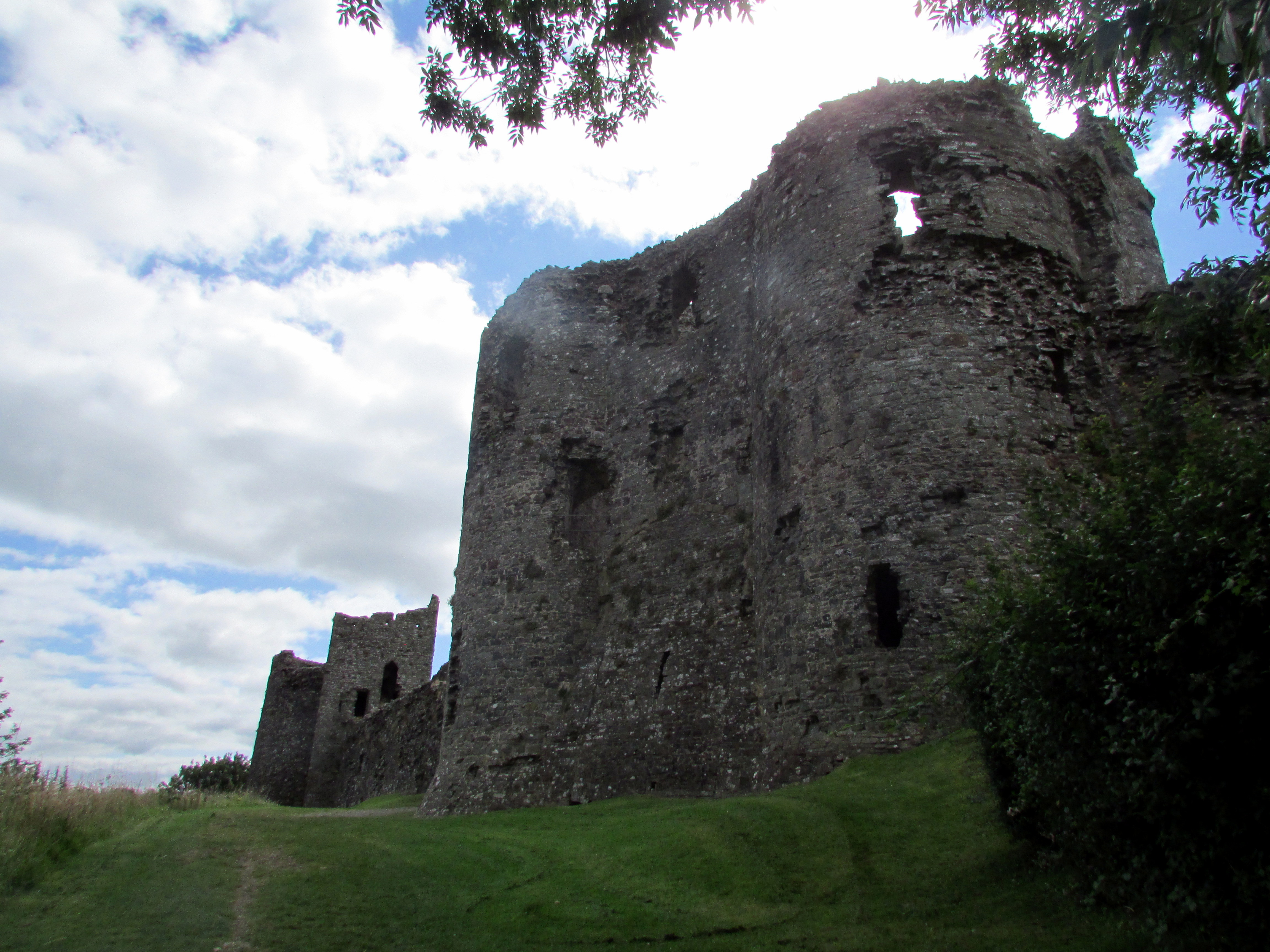
English: The castle is said to have been built c1112. In 1136, it was held by the Camville family. It was taken by Maredudd ap Gruffydd in 1146, but re-occupied by the Normans by 1158, and restored to the Camvilles. The curtain wall of the Inner Ward probably dates from Camville's refortification of the site of c1200. Recaptured by the Welsh under Llewelyn the Great in 1215, it was restored to the Camvilles yet again after 1223. The ruined Round Tower and the Inner Gate probably date from that period. The castle was briefly held by the Welsh again in 1257, but William de Camville began an extensive programme of refortification in the 1260's. At this time, the Lower Ward was enclosed in stone with two strong D-plan towers and the E bastion, and the first phase of the massive Gatehouse. After the Camville family died out in 1338, the castle passed, through marriage, to the Penres family of Gower. The castle was taken by the Welsh during the Glyndwr uprising in 1405-6. The Crown held the property during the reign of Henry VII, and it was probably at that time that the Outer Gate was made into a more comfortable residence, and the comparatively weak new gate constructed alongside it. The castle was placed in the care of the state in 1959 and is now a monument run by Cadw. |
| Date | |
| Source | https://www.flickr.com/photos/16801915@N06/24611265762/ |
| Author | Reading Tom |
| Camera location | | View this and other nearby images on: OpenStreetMap |
|---|
Licensing
This file is licensed under the Creative Commons Attribution 2.0 Generic license.
- You are free:
- to share – to copy, distribute and transmit the work
- to remix – to adapt the work
- Under the following conditions:
- attribution – You must give appropriate credit, provide a link to the license, and indicate if changes were made. You may do so in any reasonable manner, but not in any way that suggests the licensor endorses you or your use.
| This image was originally posted to Flickr by Reading Tom at https://flickr.com/photos/16801915@N06/24611265762. It was reviewed on 28 February 2023 by FlickreviewR 2 and was confirmed to be licensed under the terms of the cc-by-2.0. |
File history
Click on a date/time to view the file as it appeared at that time.
| Date/Time | Thumbnail | Dimensions | User | Comment | |
|---|---|---|---|---|---|
| current | 00:46, 28 February 2023 | | 4,608 × 3,456 (2.77 MB) | Academia45 | Uploaded a work by Reading Tom from https://www.flickr.com/photos/16801915@N06/24611265762/ with UploadWizard |
File usage
The following pages on the English Wikipedia use this file (pages on other projects are not listed):