Size of this preview: 650 × 599 pixels. Other resolutions: 260 × 240 pixels | 521 × 480 pixels | 833 × 768 pixels | 1,110 × 1,024 pixels | 2,221 × 2,048 pixels | 3,354 × 3,093 pixels.
Original file (3,354 × 3,093 pixels, file size: 1.33 MB, MIME type: image/jpeg)
| This is a file from the Wikimedia Commons. Information from its description page there is shown below. Commons is a freely licensed media file repository. You can help. |
Summary
| Description |
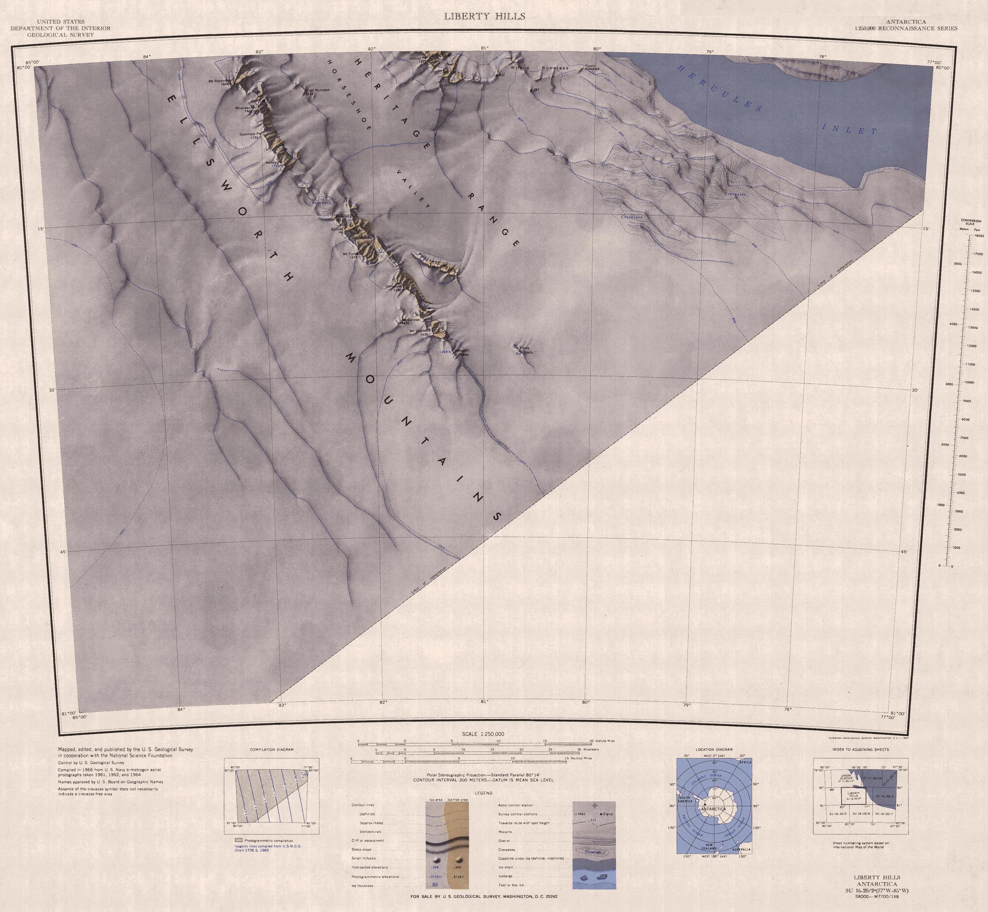
English: Map of southern Heritage Range in Ellsworth Mountains, Antarctica |
| Date | |
| Source | https://usarc.usgs.gov/drgs/dir2/c80077s1.jpg |
| Author | United States Antarctic Resource Center of the US Geological Survey |
| Other versions | Trimmed version of Wikimedia Commons File:C80077s1 Ant.Map Liberty Hills.jpg |
Licensing
This image is in the public domain in the United States because it only contains materials that originally came from the United States Geological Survey, an agency of the United States Department of the Interior. For more information, see the official USGS copyright policy.
|
File history
Click on a date/time to view the file as it appeared at that time.
| Date/Time | Thumbnail | Dimensions | User | Comment | |
|---|---|---|---|---|---|
| current | 12:30, 5 May 2017 | | 3,354 × 3,093 (1.33 MB) | Apcbg | User created page with UploadWizard |
File usage
The following pages on the English Wikipedia use this file (pages on other projects are not listed):
Global file usage
The following other wikis use this file:
- Usage on bg.wikipedia.org
- Usage on ceb.wikipedia.org
- Usage on es.wikipedia.org
- Usage on he.wikipedia.org
- Usage on it.wikipedia.org
- Usage on ja.wikipedia.org
- Usage on mk.wikipedia.org
- Usage on nn.wikipedia.org
- Usage on www.wikidata.org