No higher resolution available.
Levers_Water_-_geograph.org.uk_-_871486.jpg (640 × 480 pixels, file size: 73 KB, MIME type: image/jpeg)
| This is a file from the Wikimedia Commons. Information from its description page there is shown below. Commons is a freely licensed media file repository. You can help. |
Summary
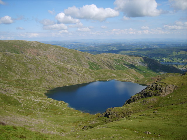
| Description |
English: Levers Water From Levers Hause. Consiston Water in shot. A reservoir associated with German POW's who worked in the area. It is however a rock basin Tarn rather than a Reservoir as now named on the map. Over 125 feet deep in parts. Named as 'Lauereswater' pre 1220. Heaton Cooper also comments that Copper in its malleable state was found above the Tarn the only record of such a find in Britain. |
| Date | |
| Source | From geograph.org.uk |
| Author | Michael Graham |
| Attribution (required by the license) | Michael Graham / Levers Water / |
| Camera location | | View this and other nearby images on: OpenStreetMap |
|---|
_heading:112.00&language=en)
| Object location | | View this and other nearby images on: OpenStreetMap |
|---|
_heading:112.00&language=en)
Licensing

|
This image was taken from the Geograph project collection. See this photograph's page on the Geograph website for the photographer's contact details. The copyright on this image is owned by Michael Graham and is licensed for reuse under the Creative Commons Attribution-ShareAlike 2.0 license.
|
This file is licensed under the Creative Commons Attribution-Share Alike 2.0 Generic license.
Attribution: Michael Graham
- You are free:
- to share – to copy, distribute and transmit the work
- to remix – to adapt the work
- Under the following conditions:
- attribution – You must give appropriate credit, provide a link to the license, and indicate if changes were made. You may do so in any reasonable manner, but not in any way that suggests the licensor endorses you or your use.
- share alike – If you remix, transform, or build upon the material, you must distribute your contributions under the same or compatible license as the original.
File history
Click on a date/time to view the file as it appeared at that time.
| Date/Time | Thumbnail | Dimensions | User | Comment | |
|---|---|---|---|---|---|
| current | 09:19, 21 February 2011 | | 640 × 480 (73 KB) | GeographBot | == {{int:filedesc}} == {{Information |description={{en|1=Levers Water From Levers Hause. Consiston Water in shot. A reservoir associated with German POW's who worked in the area. It is however a rock basin Tarn rather than a Reservoir as now named on the |
File usage
The following pages on the English Wikipedia use this file (pages on other projects are not listed):