.jpg)
.jpg&action=edit&redlink=1)

Size of this preview: 476 × 599 pixels. Other resolutions: 191 × 240 pixels | 381 × 480 pixels | 610 × 768 pixels | 814 × 1,024 pixels | 1,970 × 2,479 pixels.
Original file (1,970 × 2,479 pixels, file size: 1.37 MB, MIME type: image/jpeg)
| This is a file from the Wikimedia Commons. Information from its description page there is shown below. Commons is a freely licensed media file repository. You can help. |
.jpg)
Summary
| Description |
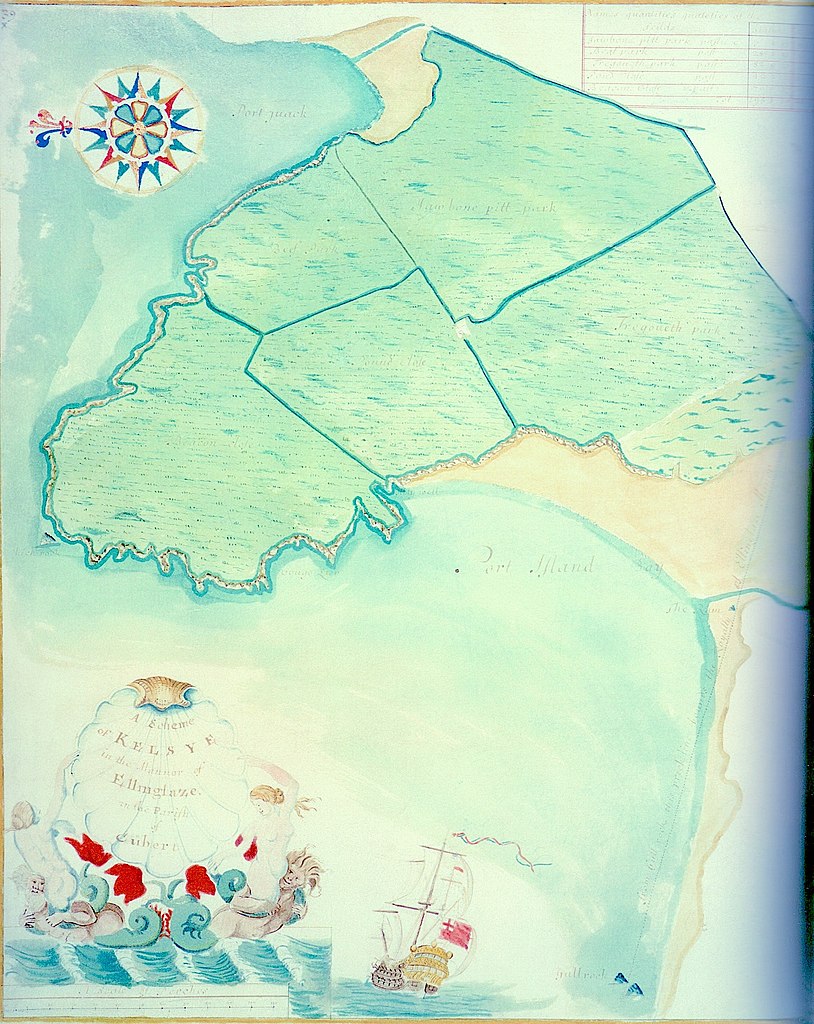
English: Kelsey Head and Holywell Bay, Cornwall as depicted by cartographer Joel Gascoyne c.1690. From the Lanhydrock Atlas. The typical colourful compass rose, bold and imaginative cartouche and maritime flavour led William Ravenhill to attribute the unsigned maps to Gascoyne for the first time. (Faithful 5" x 4" photographic transparency by Chris Bowden, here reproduced in lower resolution.) |
| Date | circa 1695 |
| Source | "The Lanhydrock Atlas: A Complete Reproduction of the 17th-Century Cornish Estate Maps", by Holden, Paul; Herring, Peter; Padel, Oliver J. (National Trust; Cornwall Editions Ltd: 2010; ISBN 978-1-904880-32-5) |
| Author | Joel Gascoyne |
Licensing
This work was never published prior to January 1, 2003, and is currently in the public domain in the United States because it meets one of the following conditions:
The above provisions are contained in 17 U.S.C. § 303. See also this page for more information. |
File history
Click on a date/time to view the file as it appeared at that time.
| Date/Time | Thumbnail | Dimensions | User | Comment | |
|---|---|---|---|---|---|
| current | 12:56, 26 October 2020 | | 1,970 × 2,479 (1.37 MB) | Ttocserp | Uploaded a work by Joel Gascoyne from The Lanhydrock Atlas: A Complete Reproduction of the 17th-Century Cornish Estate Maps with UploadWizard |
File usage
The following 2 pages use this file:
.jpg)