
Size of this preview: 800 × 600 pixels. Other resolutions: 320 × 240 pixels | 640 × 480 pixels | 1,024 × 768 pixels | 1,280 × 960 pixels | 2,048 × 1,536 pixels.
Original file (2,048 × 1,536 pixels, file size: 1.42 MB, MIME type: image/jpeg)
| This is a file from the Wikimedia Commons. Information from its description page there is shown below. Commons is a freely licensed media file repository. You can help. |
Summary
| Description |
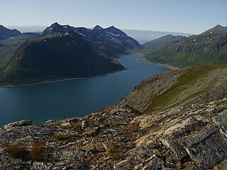
English: Langfjorden at Arnøya, Skjervøy, Troms, Norway
Norsk bokmål: Langfjorden på Arnøya i Skjervøy kommune sett fra Langfjordfjellet |
| Date | |
| Source | Nils-Arne Larsen |
| Author | Nils-Arne Larsen |
| Camera location | | View this and other nearby images on: OpenStreetMap |
|---|
Licensing
| I, the copyright holder of this work, release this work into the public domain. This applies worldwide. In some countries this may not be legally possible; if so: I grant anyone the right to use this work for any purpose, without any conditions, unless such conditions are required by law. |
File history
Click on a date/time to view the file as it appeared at that time.
| Date/Time | Thumbnail | Dimensions | User | Comment | |
|---|---|---|---|---|---|
| current | 15:55, 25 December 2009 | | 2,048 × 1,536 (1.42 MB) | Kjedalen | {{Information |Description={{en|1=Langfjorden at Arnøya, Skjervøy, Troms, Norway}} {{no|1=Langfjorden på Arnøya i Skjervøy kommune sett fra Langfjordfjellet}} |Source=Nils-Arne Larsen |Author=Nils-Arne Larsen |Date=19.07.2009 |Permission= |other_vers |
File usage
The following pages on the English Wikipedia use this file (pages on other projects are not listed):
Global file usage
The following other wikis use this file:
- Usage on ast.wikipedia.org
- Usage on az.wikipedia.org
- Usage on ca.wikipedia.org
- Usage on da.wikipedia.org
- Usage on es.wikipedia.org
- Usage on eu.wiktionary.org
- Usage on fi.wikipedia.org
- Usage on hy.wikipedia.org
- Usage on no.wikipedia.org
- Usage on pl.wiktionary.org
- Usage on ru.wikipedia.org
- Usage on www.wikidata.org
- Usage on zh.wikipedia.org