.jpg)
.jpg&action=edit&redlink=1)

Original file (1,743 × 900 pixels, file size: 1.77 MB, MIME type: image/jpeg)
| This is a file from the Wikimedia Commons. Information from its description page there is shown below. Commons is a freely licensed media file repository. You can help. |
.jpg)
Summary
| Description |
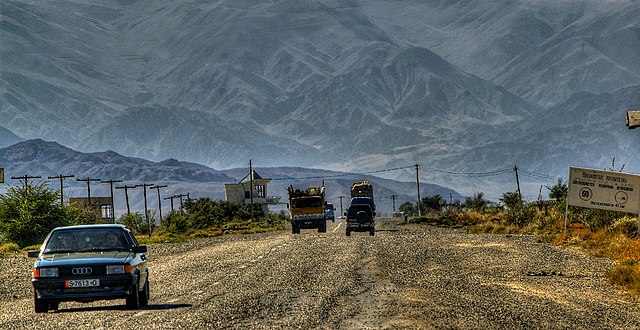
Highway A363 Bishkek towards Balykchy, lake Issyk-Kul and Chinese border (Xinjiang) Hochgebirge trennen den Norden und den Süden Kirgisistans. Die Verkehrsverbindungen sind grundsätzlich mangelhaft, abgesehen von der Gegend um Bischkek. Eine ganzjährig benutzbare Straßenverbindung von Bischkek in den Süden besteht erst seit 2003. In den Gebieten Osch, Batken und Dschalalabat sind die Hauptdurchgangsstraßen durch häufige Grenzübergänge durch usbekisches und tadschikisches Gebiet behindert, da der Straßenbau während der Sowjetzeit ohne Berücksichtigung administrativer Grenzen ausgeführt wurde. Es gibt zwei Straßenverbindungen nach China – den Torugart-Pass und die Route über Irkeschtam –, die aber im Winter häufig durch schwere Schneefälle und Lawinen blockiert sind.(Wikipedia) English: With support from the Asian Development Bank, a major road linking the north and southwest from Bishkek to Osh has recently been completed. This considerably eases communication between the two major population centres of the country—the Chuy Valley in the north and the Fergana Valley in the South. An offshoot of this road branches off across a 3,500 meter pass into the Talas Valley in the northwest. Plans are now being formulated to build a major road from Osh into China. (Wikipedia) |
| Date | 15 September 2007, 11:31 (according to Exif data) |
| Source | Kyrgyzstan |
| Author | Thomas Depenbusch (Depi) from Cologne, Germany |
| Camera location | | View this and other nearby images on: OpenStreetMap |
|---|
.jpg¶ms=042.704350_N_0075.853155_E_globe:Earth_type:camera_source:Flickr_&language=en)
Licensing
- You are free:
- to share – to copy, distribute and transmit the work
- to remix – to adapt the work
- Under the following conditions:
- attribution – You must give appropriate credit, provide a link to the license, and indicate if changes were made. You may do so in any reasonable manner, but not in any way that suggests the licensor endorses you or your use.
| This image was originally posted to Flickr by Thomas Depenbusch (Depi) at https://flickr.com/photos/8324633@N03/6052094329 (archive). It was reviewed on 26 June 2018 by FlickreviewR 2 and was confirmed to be licensed under the terms of the cc-by-2.0. |
File history
Click on a date/time to view the file as it appeared at that time.
| Date/Time | Thumbnail | Dimensions | User | Comment | |
|---|---|---|---|---|---|
| current | 02:38, 26 June 2018 | | 1,743 × 900 (1.77 MB) | Hiàn (alt) | Transferred from Flickr via #flickr2commons |
.jpg)