Size of this preview: 390 × 599 pixels. Other resolutions: 156 × 240 pixels | 312 × 480 pixels | 896 × 1,376 pixels.
Original file (896 × 1,376 pixels, file size: 1.18 MB, MIME type: image/png)
| This is a file from the Wikimedia Commons. Information from its description page there is shown below. Commons is a freely licensed media file repository. You can help. |
| Description |
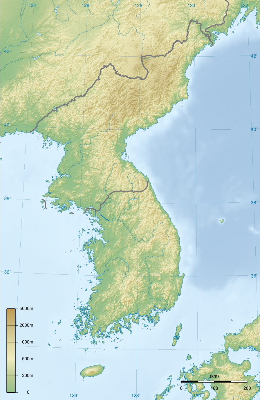
English: Topographic map of Korea.
한국어: 한국의 지형도. |
||||||||||
| Date | |||||||||||
| Source | Own work | ||||||||||
| Author | Ksiom | ||||||||||
| Permission (Reusing this file) |
|
||||||||||
| Other versions | Derivative works of this file: North Korea topographic map.png |

File history
Click on a date/time to view the file as it appeared at that time.
| Date/Time | Thumbnail | Dimensions | User | Comment | |
|---|---|---|---|---|---|
| current | 18:00, 27 February 2009 | | 896 × 1,376 (1.18 MB) | Ksiom | Reverted to version as of 23:21, 21 February 2009. Unimpaired scale bar |
| 15:08, 22 February 2009 |  | 802 × 1,376 (1.11 MB) | Valentim | Reverted to version as of 10:45, 31 January 2009. Focused view better. | |
| 23:21, 21 February 2009 |  | 896 × 1,376 (1.18 MB) | Ksiom | Reverted to version as of 22:04, 13 November 2008 | |
| 10:45, 31 January 2009 |  | 802 × 1,376 (1.11 MB) | Valentim | View centered on North and South Korea | |
| 22:04, 13 November 2008 |  | 896 × 1,376 (1.18 MB) | Ksiom | ||
| 23:11, 16 August 2008 |  | 899 × 1,379 (1.3 MB) | Ksiom | ||
| 19:33, 15 August 2008 |  | 1,039 × 1,494 (1.36 MB) | Ksiom | ||
| 18:34, 15 August 2008 |  | 1,040 × 1,494 (1.36 MB) | Ksiom | UTM Projection | |
| 00:52, 9 August 2008 |  | 1,000 × 1,450 (1.33 MB) | Ksiom | {{Information |Description={{en|1=Topographic map of Korea.}} {{ko|1=한국의 지형도.}} |Source=Own work by uploader |Author=Ksiom |Date=2008-08-09 |Permission={{GFDL-GMT}} |other_versions= }} {{ImageUpload|full}} [[Category:Maps of Ko |
File usage
The following pages on the English Wikipedia use this file (pages on other projects are not listed):
Global file usage
The following other wikis use this file:
- Usage on ang.wikipedia.org
- Usage on br.wikipedia.org
- Usage on da.wikipedia.org
- Usage on da.wikibooks.org
- Usage on fr.wikipedia.org
- Usage on fr.wiktionary.org
- Usage on mt.wikipedia.org