No higher resolution available.
Khyber_Pass_Area_Map.jpg (505 × 310 pixels, file size: 88 KB, MIME type: image/jpeg)
| This is a file from the Wikimedia Commons. Information from its description page there is shown below. Commons is a freely licensed media file repository. You can help. |
| Description |
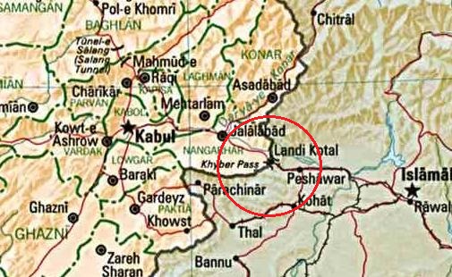
English: Map of Afghanistan
മലയാളം: ഖൈബർ ചുരത്തിനടുത്ത്, പാകിസ്താൻ അഫ്ഘാനിസ്താൻ അതിർത്തിപ്രദേശത്തിന്റെ ഭൂപടം |
| Date | (UTC) |
| Source | |
| Author |
|
| This is a retouched picture, which means that it has been digitally altered from its original version. Modifications: ഖൈബർ ചുരം വളയത്തിലാക്കി. The original can be viewed here: Afghan-big.jpg:
|
| This image is a work of a Central Intelligence Agency employee, taken or made as part of that person's official duties. As a Work of the United States Government, this image or media is in the public domain in the United States.
|

|
Original upload log
This image is a derivative work of the following images:
- File:Afghan-big.jpg licensed with PD-USGov-CIA
- 2006-12-16T23:24:27Z Electionworld 1378x1480 (348278 Bytes) {{ew|en|Ijomer}} Map of Afghanistan *CREATED/PUBLISHED: Central Intelligence Agency, 1993 *source: http://memory.loc.gov/cgi-bin/query/r?ammem/gmd:@field(NUMBER+@band(g7630+ct000721)) {{PD-USGov-CIA}}
Uploaded with derivativeFX
File history
Click on a date/time to view the file as it appeared at that time.
| Date/Time | Thumbnail | Dimensions | User | Comment | |
|---|---|---|---|---|---|
| current | 18:16, 12 December 2010 | | 505 × 310 (88 KB) | Sreejithk2000 | {{Information |Description={{en|Map of Afghanistan}} {{ml|ഖൈബർ ചുരത്തിനടുത്ത്, പാകിസ്താൻ അഫ്ഘാനിസ്താൻ അതിർത്തിപ്രദേശത്തിന |
File usage
The following pages on the English Wikipedia use this file (pages on other projects are not listed):
Global file usage
The following other wikis use this file:
- Usage on fa.wikipedia.org
- Usage on hu.wikipedia.org
- Usage on ml.wikipedia.org
- Usage on or.wikipedia.org
- Usage on ur.wikipedia.org