Karta_Karthago_fr.png (555 × 520 pixels, file size: 18 KB, MIME type: image/png)
File history
Click on a date/time to view the file as it appeared at that time.
| Date/Time | Thumbnail | Dimensions | User | Comment | |
|---|---|---|---|---|---|
| current | 17:14, 29 October 2007 |  | 555 × 520 (18 KB) | Moumou82 | |
| 15:08, 28 October 2007 |  | 555 × 520 (13 KB) | Ripounet | ||
| 17:53, 26 October 2007 |  | 555 × 520 (13 KB) | Ripounet | ||
| 22:11, 25 October 2007 |  | 555 × 520 (13 KB) | Ripounet | ||
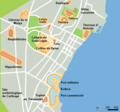
| 21:59, 25 October 2007 |  | 555 × 520 (13 KB) | Ripounet | == Summary == Made out of Image:Karta Karthago.PNG map of modern Carthage showing remaining ruins from punic and roman era, (own work composed from various mapreferences) date: 2005-04-25 == Licensing == {{PD-self}} Category:Maps of Carthage |
File usage
The following page uses this file:
Global file usage
The following other wikis use this file:
- Usage on ca.wikipedia.org
- Usage on es.wikipedia.org
- Usage on fr.wikipedia.org
- Usage on it.wikipedia.org
