Size of this PNG preview of this SVG file: 696 × 599 pixels. Other resolutions: 279 × 240 pixels | 557 × 480 pixels | 892 × 768 pixels | 1,189 × 1,024 pixels | 2,378 × 2,048 pixels | 1,377 × 1,186 pixels.
Original file (SVG file, nominally 1,377 × 1,186 pixels, file size: 829 KB)
File history
Click on a date/time to view the file as it appeared at that time.
| Date/Time | Thumbnail | Dimensions | User | Comment | |
|---|---|---|---|---|---|
| current | 18:41, 30 December 2020 |  | 1,377 × 1,186 (829 KB) | Don-kun | fix frame |
| 18:39, 30 December 2020 |  | 1,384 × 1,193 (829 KB) | Don-kun | other font | |
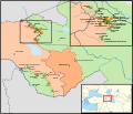
| 14:08, 22 December 2020 |  | 1,384 × 1,193 (1.12 MB) | Don-kun | {{Information |Description=Armenian–Azerbaijani clashes before the war in 2020 |Source={{own}};<br /> official borders: Armenia adm location map.svg, Azerbaijan adm location map.svg;<br /> water bodies: OpenStreetMap |Date=2020-12-22 |Author=Don-kun, sources: NordNordWest |Permission= |other_versions= }} Category:Maps of the 2020 Nagorno-Karabakh conflict [[Category:Maps... |
File usage
No pages on the English Wikipedia use this file (pages on other projects are not listed).
Global file usage
The following other wikis use this file:
- Usage on de.wikipedia.org
- Usage on eu.wikipedia.org