
Size of this preview: 800 × 392 pixels. Other resolutions: 320 × 157 pixels | 640 × 313 pixels | 1,024 × 501 pixels | 1,920 × 940 pixels.
Original file (1,920 × 940 pixels, file size: 1.32 MB, MIME type: image/png)
| This is a file from the Wikimedia Commons. Information from its description page there is shown below. Commons is a freely licensed media file repository. You can help. |
Summary
| Description |
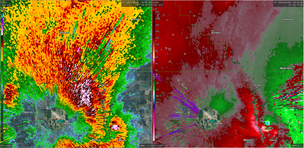
English: Close-range NEXRAD radar data of the Elkhorn, Nebraska EF4 tornado. |
| Date | |
| Source | NEXRAD KOAX |
| Author | National Weather Service, Federal Aviation Administration & United States Air Force |
Licensing
This image is in the public domain because it is from one or more of the U.S. government’s 159 NEXRAD radars, which are jointly owned and operated by the National Weather Service (NWS), an agency of the National Oceanic and Atmospheric Administration (NOAA) within the United States Department of Commerce, the Federal Aviation Administration (FAA) within the Department of Transportation, and the U.S. Air Force within the Department of Defense.
Thus all NEXRAD images are public domain.
|
  |
File history
Click on a date/time to view the file as it appeared at that time.
| Date/Time | Thumbnail | Dimensions | User | Comment | |
|---|---|---|---|---|---|
| current | 17:14, 30 July 2024 | | 1,920 × 940 (1.32 MB) | Nicholas Krasznavolgyi | Uploaded a work by National Oceanic and Atmospheric Administration from GR2Analyst v3 - KOAX Radar with UploadWizard |
File usage
The following pages on the English Wikipedia use this file (pages on other projects are not listed):