
Size of this preview: 459 × 599 pixels. Other resolutions: 184 × 240 pixels | 368 × 480 pixels | 588 × 768 pixels | 784 × 1,024 pixels | 1,569 × 2,048 pixels | 7,200 × 9,400 pixels.
Original file (7,200 × 9,400 pixels, file size: 10.39 MB, MIME type: image/jpeg)
| This is a file from the Wikimedia Commons. Information from its description page there is shown below. Commons is a freely licensed media file repository. You can help. |
Summary
| Description |
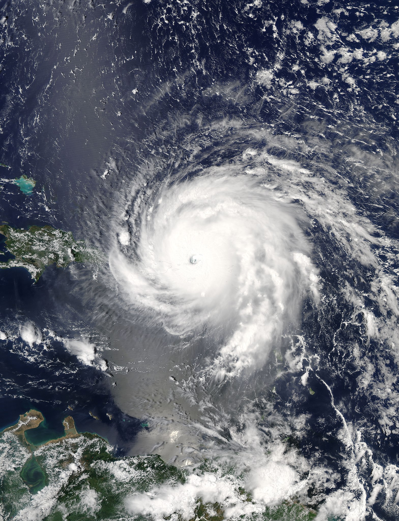
English: Hurricane Irma over the Virgin Islands at peak intensity on September 6, 2017 as the second most intense Atlantic hurricane on record in terms of sustained winds. |
| Date | |
| Source | Rapid Response - LANCE |
| Author | MODIS image captured by NASA’s Aqua satellite |
| Camera location | | View this and other nearby images on: OpenStreetMap |
|---|
Licensing
| This file is in the public domain in the United States because it was solely created by NASA. NASA copyright policy states that "NASA material is not protected by copyright unless noted". (See Template:PD-USGov, NASA copyright policy page or JPL Image Use Policy.) | ||
 |
Warnings:
|
File history
Click on a date/time to view the file as it appeared at that time.
| Date/Time | Thumbnail | Dimensions | User | Comment | |
|---|---|---|---|---|---|
| current | 03:58, 5 February 2018 | | 7,200 × 9,400 (10.39 MB) | A1Cafel | 250m |
| 21:46, 6 September 2017 |  | 7,200 × 9,600 (18.71 MB) | Meow | User created page with UploadWizard |
File usage
The following pages on the English Wikipedia use this file (pages on other projects are not listed):
- 2017 in the British Virgin Islands
- Hurricanes in the Virgin Islands
- User:Wiki Feed Bot/test
- Wikipedia:Main Page history/2017 September 10
- Wikipedia:Main Page history/2017 September 11
- Wikipedia:Main Page history/2017 September 12
- Wikipedia:Main Page history/2017 September 13
- Wikipedia:Main Page history/2017 September 14
- Wikipedia:Main Page history/2017 September 7
- Wikipedia:Main Page history/2017 September 8
- Wikipedia:Main Page history/2017 September 9
- Wikipedia:Top 25 Report/September 10 to 16, 2017
- Wikipedia:Top 25 Report/September 3 to 9, 2017
- Wikipedia:Wikipedia Signpost/2017-09-25/Traffic report
- Wikipedia:Wikipedia Signpost/Single/2017-09-25
Global file usage
The following other wikis use this file:
- Usage on ar.wikipedia.org
- Usage on bh.wikipedia.org
- Usage on bn.wikipedia.org
- Usage on cs.wikipedia.org
- Usage on da.wikipedia.org
- Usage on de.wikipedia.org
- Usage on de.wikinews.org
- Usage on fa.wikipedia.org
- Usage on fi.wikipedia.org
- Usage on fr.wikipedia.org
- Usage on fy.wikipedia.org
- Usage on id.wikipedia.org
- Usage on it.wikipedia.org
- Usage on ko.wikipedia.org
- Usage on la.wikipedia.org
- Usage on min.wikipedia.org
- Usage on ms.wikipedia.org
- Usage on pl.wikipedia.org
- Usage on pt.wikipedia.org
- Usage on sco.wikipedia.org
- Usage on so.wikipedia.org
- Usage on sw.wikipedia.org
- Usage on tr.wikipedia.org
- Usage on zh.wikipedia.org