
Size of this PNG preview of this SVG file: 545 × 599 pixels. Other resolutions: 218 × 240 pixels | 436 × 480 pixels | 698 × 768 pixels | 931 × 1,024 pixels | 1,862 × 2,048 pixels | 551 × 606 pixels.
Original file (SVG file, nominally 551 × 606 pixels, file size: 75 KB)
| This is a file from the Wikimedia Commons. Information from its description page there is shown below. Commons is a freely licensed media file repository. You can help. |
Summary
| Description |
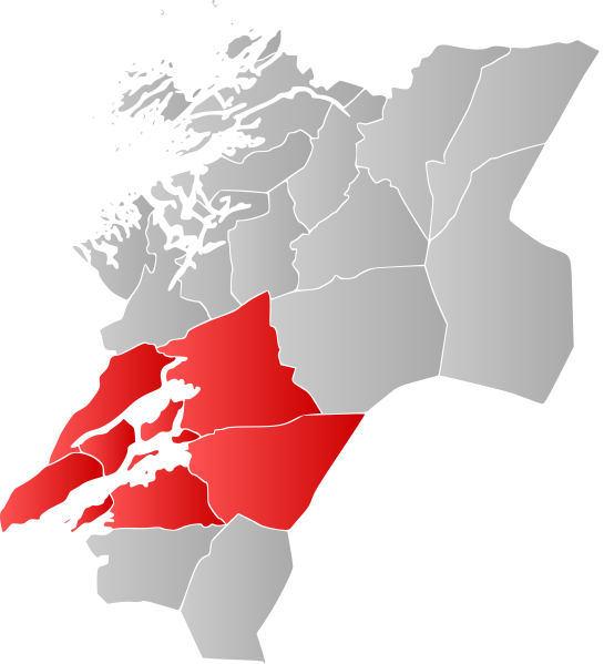
Norsk nynorsk: Kart over Nord-Trøndelag fylke, med kommunane innan Innherad utheva i raudt.
English: Map showing the municipalities in the district of Innherad in North-Trøndelag, Norway. |
||
| Date | |||
| Source | Based upon File:NO 1724 Verran.svg | ||
| Author |
Own work This W3C-unspecified vector image was created with Inkscape . |
||
| Permission (Reusing this file) |
|
Licensing
| I, the copyright holder of this work, release this work into the public domain. This applies worldwide. In some countries this may not be legally possible; if so: I grant anyone the right to use this work for any purpose, without any conditions, unless such conditions are required by law. |
File history
Click on a date/time to view the file as it appeared at that time.
| Date/Time | Thumbnail | Dimensions | User | Comment | |
|---|---|---|---|---|---|
| current | 19:10, 19 August 2010 | | 551 × 606 (75 KB) | Fleinn | {{Information |Description={{nn|1=Kart over Nord-Trøndelag fylke, med kommunane innan Innherad utheva i raudt.}} {{en|1=Map showing the municipalities in the district of Innherad in North-Trøndelag, Norway.}} |Source=Based upon [[:File:NO 1724 Verran.sv |
File usage
The following pages on the English Wikipedia use this file (pages on other projects are not listed):
Global file usage
The following other wikis use this file: