Size of this preview: 800 × 432 pixels. Other resolutions: 320 × 173 pixels | 640 × 346 pixels | 927 × 501 pixels.
Original file (927 × 501 pixels, file size: 988 KB, MIME type: image/png)
| This is a file from the Wikimedia Commons. Information from its description page there is shown below. Commons is a freely licensed media file repository. You can help. |
Summary
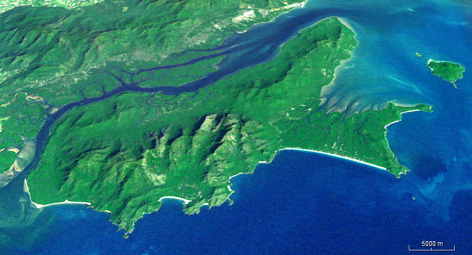
| Description | en:Hinchinbrook Island looking west, no vertical exaggeration. |
| Source | Generated using en:NASA World Wind from i-cubed en:Landsat data (15-meter/pixel resolution Landsat 7 Global Mosaic) |
| Author | NASA |
Licensing
| This image is in the public domain because it is a screenshot from NASA’s globe software World Wind using a public domain layer, such as Blue Marble, MODIS, Landsat, SRTM, USGS or GLOBE.
|
 |
File history
Click on a date/time to view the file as it appeared at that time.
| Date/Time | Thumbnail | Dimensions | User | Comment | |
|---|---|---|---|---|---|
| current | 08:38, 4 July 2011 | | 927 × 501 (988 KB) | Sean.hoyland | Image too dark. Increase brightness/contrast. |
| 17:29, 3 July 2011 |  | 927 × 501 (1.78 MB) | Sean.hoyland | {{Information |Description=en:Hinchinbrook Island looking west, no vertical exaggeration. |Source=Generated using en:NASA World Wind from i-cubed en:Landsat data |Date= |Author=NASA |Permission= |other_versions= }} |
File usage
The following pages on the English Wikipedia use this file (pages on other projects are not listed):
Global file usage
The following other wikis use this file:
- Usage on ceb.wikipedia.org
- Usage on de.wikipedia.org
- Usage on en.wikivoyage.org
- Usage on fr.wikipedia.org
- Usage on he.wikivoyage.org
- Usage on it.wikipedia.org
- Usage on it.wikivoyage.org
- Usage on ru.wikipedia.org
- Usage on ur.wikipedia.org
- Usage on www.wikidata.org