
Size of this PNG preview of this SVG file: 550 × 370 pixels. Other resolutions: 320 × 215 pixels | 640 × 431 pixels | 1,024 × 689 pixels | 1,280 × 861 pixels | 2,560 × 1,722 pixels.
Original file (SVG file, nominally 550 × 370 pixels, file size: 108 KB)
| This is a file from the Wikimedia Commons. Information from its description page there is shown below. Commons is a freely licensed media file repository. You can help. |
Summary
| Description |
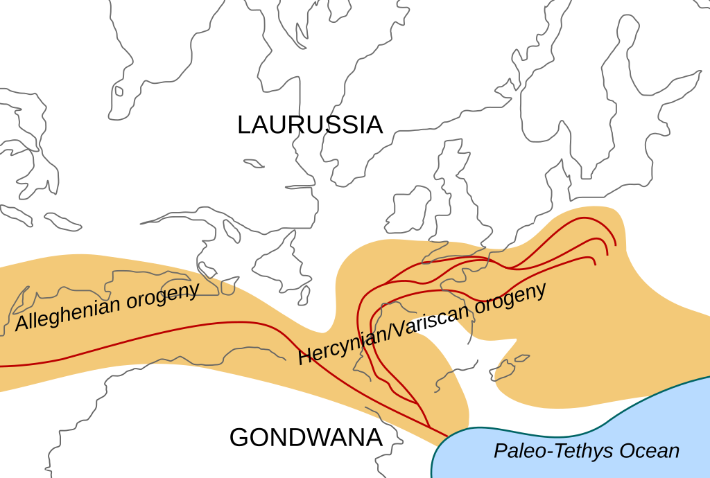
English: Location of the Hercynian/Variscan/Alleghanian mountain chains in the middle of the Carboniferous period. Present day coastlines are shown for reference. Red lines are sutures, capitalized names are the different continents that joined during these orogenies.
Literature used to make this map:
|
| Date | |
| Source | Own work |
| Author | Woudloper |
| Other versions |
Derivative works of this file: Image:Hercynides NL.svg, Image:Hercynides DE.svg, Image:Hercynides IT.svg |

|
This SVG file contains embedded text that can be translated into your language, using any capable SVG editor, text editor or the SVG Translate tool. For more information see: About translating SVG files. |
Licensing
This file is licensed under the Creative Commons Attribution-Share Alike 1.0 Generic license.
- You are free:
- to share – to copy, distribute and transmit the work
- to remix – to adapt the work
- Under the following conditions:
- attribution – You must give appropriate credit, provide a link to the license, and indicate if changes were made. You may do so in any reasonable manner, but not in any way that suggests the licensor endorses you or your use.
- share alike – If you alter, transform, or build upon this work, you must distribute the resulting work under the same license as the original.
File history
Click on a date/time to view the file as it appeared at that time.
| Date/Time | Thumbnail | Dimensions | User | Comment | |
|---|---|---|---|---|---|
| current | 19:29, 2 December 2008 | | 550 × 370 (108 KB) | Woudloper | {{Information |Description={{en|1=Location of the Hercynian/Variscan/Alleghanian mountain chains in the middle of the Carboniferous period. Present day coastlines are shown for reference. Red lines are sutures, capitalized names are the different continen |
File usage
The following pages on the English Wikipedia use this file (pages on other projects are not listed):
Global file usage
The following other wikis use this file:
- Usage on ca.wikipedia.org
- Usage on fa.wikipedia.org
- Usage on fr.wikipedia.org
- Usage on gl.wikipedia.org
- Usage on nn.wikipedia.org
- Usage on pl.wikipedia.org
- Usage on ro.wikipedia.org
- Usage on tr.wikipedia.org
- Usage on zh.wikipedia.org