,_Yorkshire_(geograph_5658332).jpg)
,_Yorkshire_(geograph_5658332).jpg&action=edit&redlink=1)
Size of this preview: 800 × 600 pixels. Other resolutions: 320 × 240 pixels | 640 × 480 pixels | 1,024 × 768 pixels | 1,280 × 960 pixels | 1,600 × 1,200 pixels.
Original file (1,600 × 1,200 pixels, file size: 548 KB, MIME type: image/jpeg)
| This is a file from the Wikimedia Commons. Information from its description page there is shown below. Commons is a freely licensed media file repository. You can help. |
,_Yorkshire_(geograph_5658332).jpg)
Summary
| Description |
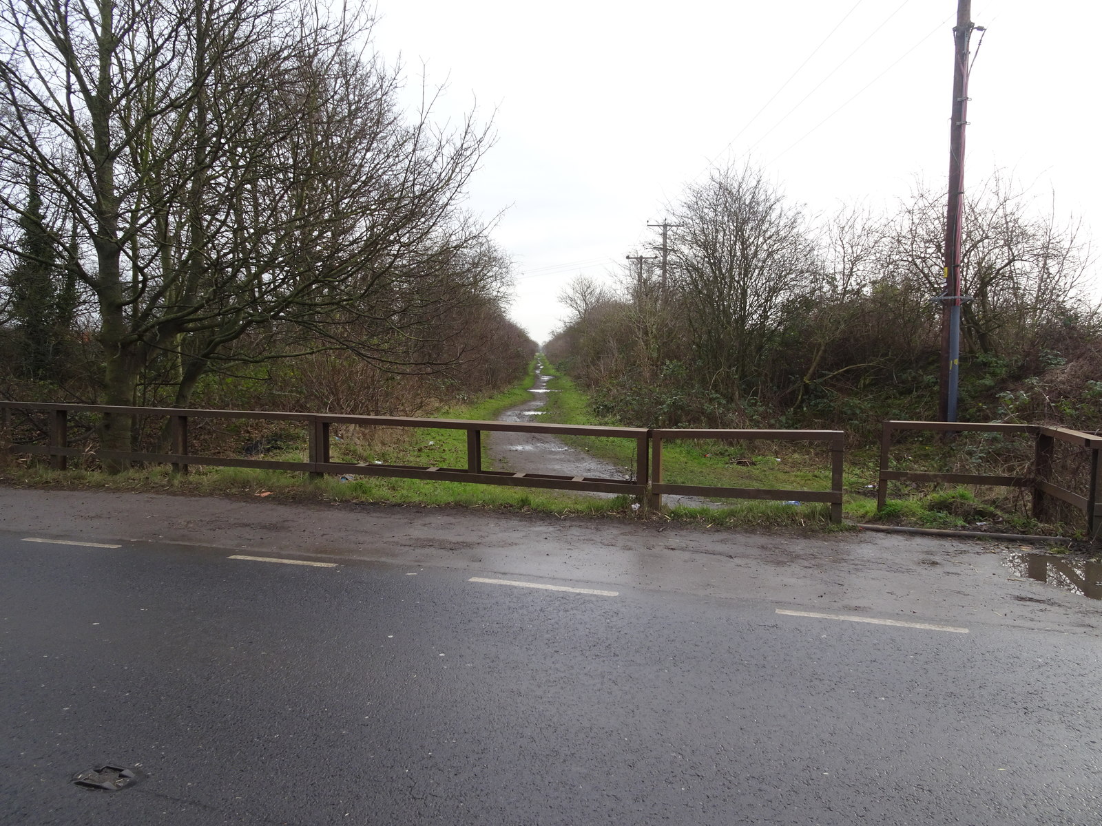
English: Hedon Racecourse railway Halt (site), Salt End, East Riding of Yorkshire, England. Opened in 1888 by the North Eastern Railway, on the line from Hull Paragon to Withernsea, this station closed in 1909. It reopened briefly as Hedon Speedway Halt in 1948 but closed again in 1949. View east towards Hedon and Withernsea. Both platforms were extant when this image was taken, hidden by the undergrowth. |
| Date | |
| Source | From geograph.org.uk |
| Author | Nigel Thompson |
| Permission (Reusing this file) |
Creative Commons Attribution Share-alike license 2.0 |
| Attribution (required by the license) | Nigel Thompson / Hedon Racecourse railway Halt (site), Yorkshire / |
| Camera location | | View this and other nearby images on: OpenStreetMap |
|---|
,_Yorkshire_(geograph_5658332).jpg¶ms=053.747867_N_-000.228454_E_globe:Earth_type:camera_source:geograph-osgb36(TA16922940)_heading:90.00&language=en)
| Object location | | View this and other nearby images on: OpenStreetMap |
|---|
,_Yorkshire_(geograph_5658332).jpg¶ms=053.747860_N_-000.227700_E_globe:Earth_class:object_type:object_source:geograph-osgb36(TA16972940)_heading:90.00&language=en)
Licensing

|
This image was taken from the Geograph project collection. See this photograph's page on the Geograph website for the photographer's contact details. The copyright on this image is owned by Nigel Thompson and is licensed for reuse under the Creative Commons Attribution-ShareAlike 2.0 license.
|
This file is licensed under the Creative Commons Attribution-Share Alike 2.0 Generic license.
Attribution: Nigel Thompson
- You are free:
- to share – to copy, distribute and transmit the work
- to remix – to adapt the work
- Under the following conditions:
- attribution – You must give appropriate credit, provide a link to the license, and indicate if changes were made. You may do so in any reasonable manner, but not in any way that suggests the licensor endorses you or your use.
- share alike – If you remix, transform, or build upon the material, you must distribute your contributions under the same or compatible license as the original.
File history
Click on a date/time to view the file as it appeared at that time.
| Date/Time | Thumbnail | Dimensions | User | Comment | |
|---|---|---|---|---|---|
| current | 19:30, 4 September 2018 | | 1,600 × 1,200 (548 KB) | Schlosser67 | Transferred from geograph.co.uk using [https://tools.wmflabs.org/geograph2commons/ geograph2commons] |
File usage
The following pages on the English Wikipedia use this file (pages on other projects are not listed):
Global file usage
The following other wikis use this file:
- Usage on www.wikidata.org
,_Yorkshire_(geograph_5658332).jpg)