
Size of this preview: 800 × 503 pixels. Other resolutions: 320 × 201 pixels | 640 × 403 pixels | 1,159 × 729 pixels.
Original file (1,159 × 729 pixels, file size: 1.29 MB, MIME type: image/png)
| This is a file from the Wikimedia Commons. Information from its description page there is shown below. Commons is a freely licensed media file repository. You can help. |
Summary
| Description |
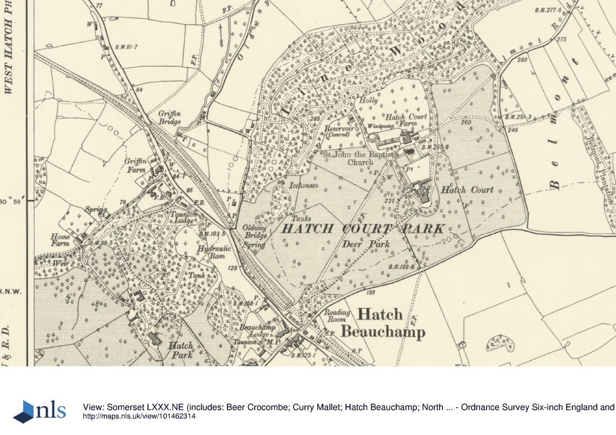
English: 1886 Ordnance Survey map (6 inches to one mile) of Hatch Beauchamp, Somerset, England. |
| Date | |
| Source | https://www.parksandgardens.org/assets/uploads/places/_1200xAUTO_fit_center-center_none/pgds_20160713-081827_hatchcourt19041.jpg |
| Author | Unknown Ordnance Survey cartographer |
Licensing
|
This work is in the public domain in its country of origin and other countries and areas where the copyright term is the author's life plus 100 years or fewer. | |
| This file has been identified as being free of known restrictions under copyright law, including all related and neighboring rights. | |
File history
Click on a date/time to view the file as it appeared at that time.
| Date/Time | Thumbnail | Dimensions | User | Comment | |
|---|---|---|---|---|---|
| current | 14:13, 26 April 2020 | | 1,159 × 729 (1.29 MB) | Lobsterthermidor | {{Information |description ={{en|1=1886 Ordnance Survey map (6 inches to one mile) of Hatch Beauchamp, Somerset, England.}} |date =1886 |source =https://www.parksandgardens.org/assets/uploads/places/_1200xAUTO_fit_center-center_none/pgds_20160713-081827_hatchcourt19041.jpg |author =Unknown Ordnance Survey cartographer }} Category:Hatch Beauchamp Category:Maps of Somerset |
File usage
The following pages on the English Wikipedia use this file (pages on other projects are not listed):