
Size of this preview: 800 × 388 pixels. Other resolutions: 320 × 155 pixels | 640 × 310 pixels | 1,037 × 503 pixels.
Original file (1,037 × 503 pixels, file size: 1.13 MB, MIME type: image/png)
| This is a file from the Wikimedia Commons. Information from its description page there is shown below. Commons is a freely licensed media file repository. You can help. |
| Description |
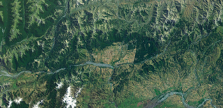
English: Satellite photo of the Hanmer Basin, South Island, New Zealand |
|||
| Source | Screenshot from NASA WorldWind software | |||
| Author | Mikenorton | |||
| Permission (Reusing this file) |
|

File history
Click on a date/time to view the file as it appeared at that time.
| Date/Time | Thumbnail | Dimensions | User | Comment | |
|---|---|---|---|---|---|
| current | 00:05, 18 July 2010 | | 1,037 × 503 (1.13 MB) | Mikenorton | {{Information |Description={{en|1=Satellite photo of the Hanmer Basin, South Island, New Zealand}} |Source=Screenshot from NASA WorldWind software |Author=Mikenorton |Date= |Permission={{PD-WorldWind}} |other_versions= }} Category:New Zealand [[Categ |
File usage
The following pages on the English Wikipedia use this file (pages on other projects are not listed):
Global file usage
The following other wikis use this file:
- Usage on pl.wikipedia.org
- Usage on ru.wikipedia.org