
No higher resolution available.
HUC1810.jpg (632 × 435 pixels, file size: 330 KB, MIME type: image/jpeg)
| This is a file from the Wikimedia Commons. Information from its description page there is shown below. Commons is a freely licensed media file repository. You can help. |
Summary
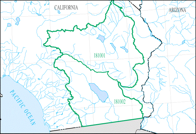
| Description |
English: Map of HUC1810 - The closed desert basins in Southeastern California, including the Lower Mojave Desert and the Salton Sea. |
| Date | |
| Source | https://water.usgs.gov/wsc/sub/1810.jpg |
| Author | USGS |
Licensing
This image is in the public domain in the United States because it only contains materials that originally came from the United States Geological Survey, an agency of the United States Department of the Interior. For more information, see the official USGS copyright policy.
|
File history
Click on a date/time to view the file as it appeared at that time.
| Date/Time | Thumbnail | Dimensions | User | Comment | |
|---|---|---|---|---|---|
| current | 19:01, 20 September 2018 | | 632 × 435 (330 KB) | Furicorn | Transferred from https://water.usgs.gov/wsc/sub/1810.jpg |
File usage
The following pages on the English Wikipedia use this file (pages on other projects are not listed):