Size of this preview: 759 × 600 pixels. Other resolutions: 304 × 240 pixels | 607 × 480 pixels | 972 × 768 pixels | 1,280 × 1,012 pixels | 2,560 × 2,023 pixels | 5,500 × 4,347 pixels.
Original file (5,500 × 4,347 pixels, file size: 9.96 MB, MIME type: image/jpeg)
| This is a file from the Wikimedia Commons. Information from its description page there is shown below. Commons is a freely licensed media file repository. You can help. |
Summary
| Description |
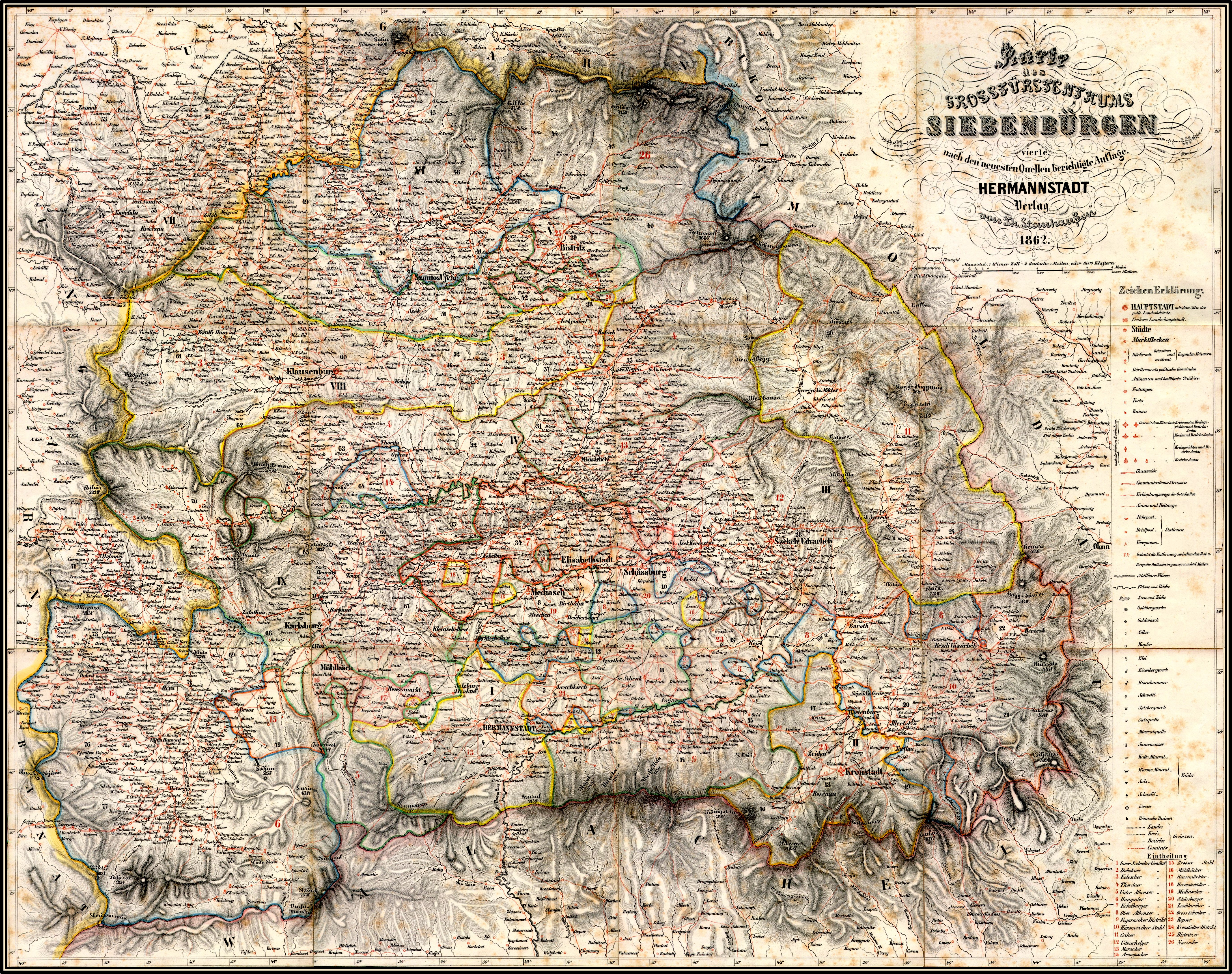
English: Map of the Grand Duchy of Transylvania, 1862
Deutsch: Karte des Großfürstentums Siebenbürgen, 1862
Română: Harta Marelui Principat al Transilvaniei, 1862
Magyar: Térkép Erdélyi Fejedelemség, 1862 |
| Date | |
| Source |
Assembled from 12 individual historical maps of the public domain map collection
|
| Author | DietG |
| Other versions | Derivative works of this file: Großfürstentum Siebenbürgen 1862-Komitat Kokelburg.jpg |
Licensing
| I, the copyright holder of this work, release this work into the public domain. This applies worldwide. In some countries this may not be legally possible; if so: I grant anyone the right to use this work for any purpose, without any conditions, unless such conditions are required by law. |
File history
Click on a date/time to view the file as it appeared at that time.
| Date/Time | Thumbnail | Dimensions | User | Comment | |
|---|---|---|---|---|---|
| current | 21:17, 21 August 2010 | | 5,500 × 4,347 (9.96 MB) | DietG | Enhanced even more |
| 17:56, 17 July 2010 |  | 5,551 × 4,419 (10.37 MB) | DietG | Enhanced | |
| 11:37, 9 July 2010 |  | 5,450 × 4,296 (10.24 MB) | DietG | {{Information |Description={{en|1=Map of the Grand Duchy of Transylvania, 1862}} {{de|1=Karte des Großfürstentums Siebenbürgen, 1862}} {{ro|1=Harta Marelui Principat al Transilvaniei, 1862}} |Source=Karte des Grossfürstentums Siebenbürgen : Vierte na |
File usage
No pages on the English Wikipedia use this file (pages on other projects are not listed).
Global file usage
The following other wikis use this file:
- Usage on de.wikipedia.org
- Usage on de.wikivoyage.org
- Usage on fr.wikipedia.org
- Usage on www.wikidata.org