
Size of this PNG preview of this SVG file: 627 × 599 pixels. Other resolutions: 251 × 240 pixels | 502 × 480 pixels | 803 × 768 pixels | 1,071 × 1,024 pixels | 2,143 × 2,048 pixels | 1,655 × 1,582 pixels.
Original file (SVG file, nominally 1,655 × 1,582 pixels, file size: 3.05 MB)
| This is a file from the Wikimedia Commons. Information from its description page there is shown below. Commons is a freely licensed media file repository. You can help. |
Summary
| Description |
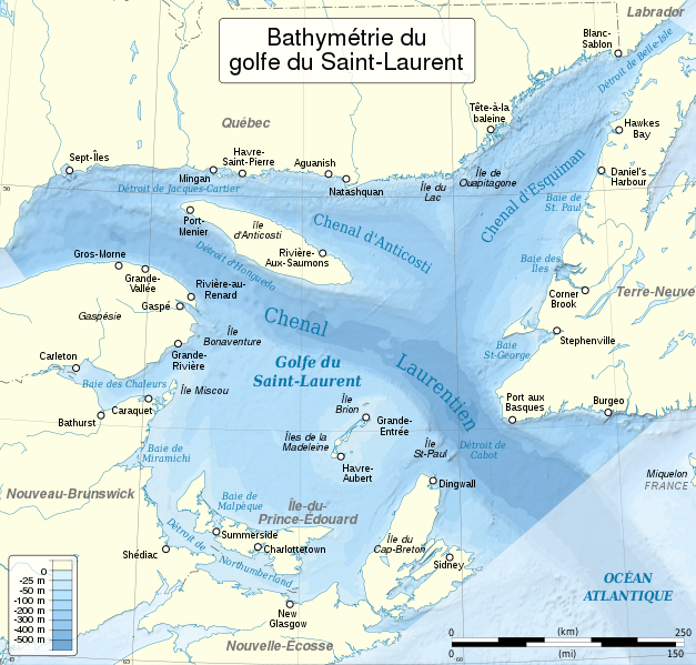
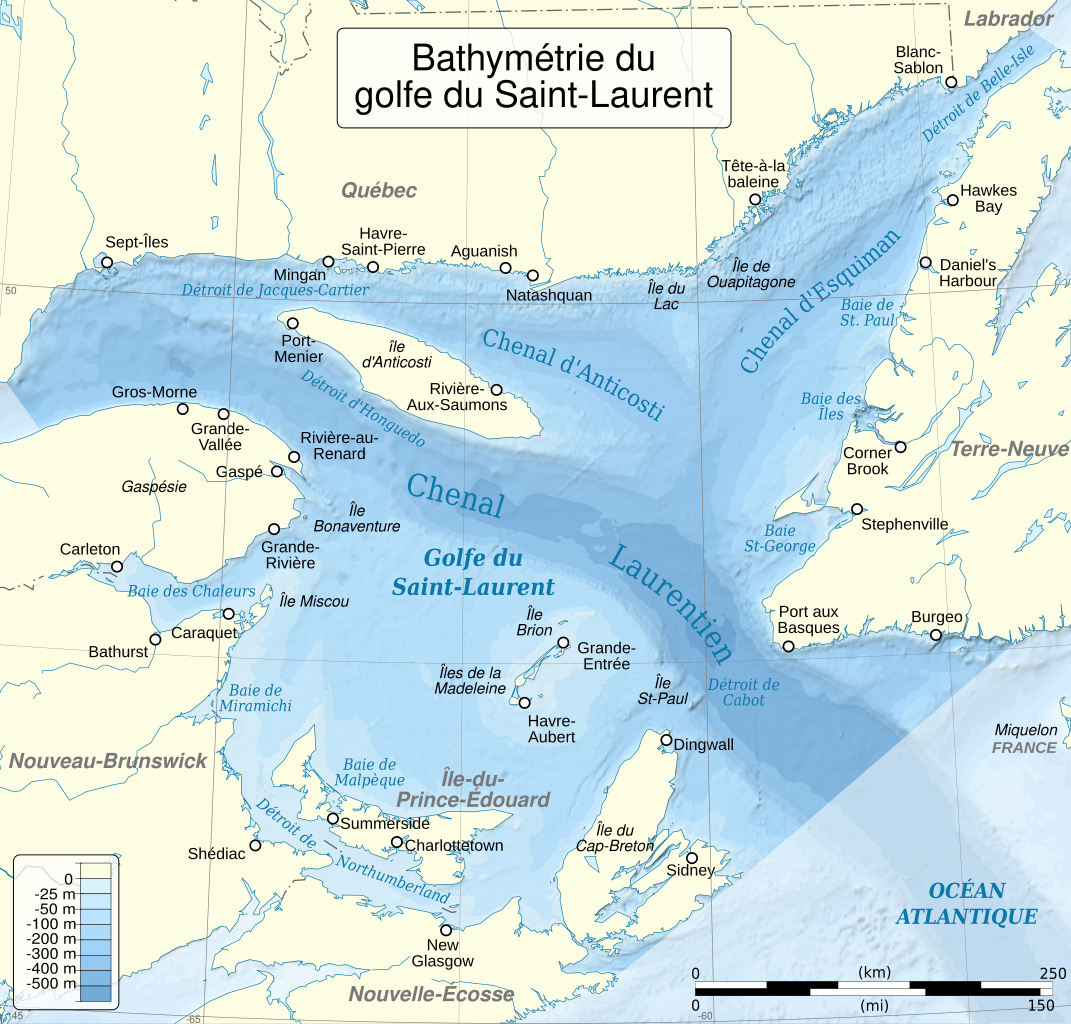
English: Depths/bathymetry of the Saint Lawrence Gulf. Cartographic data :
Français : Profondeurs/bathymétrie du golfe du Saint-Laurent. Données cartographiques :
|
||
| Date | |||
| Source |
English: Source :
|
||
| Author |
|
||
| Other versions |
Derivative works of this file: Old Harry oil field location map-fr.svg | ||
| Attribution (required by the license) | © Ewan ar Born & Sémhur / Wikimedia Commons / | ||
| SVG | W3C-validity not checked.
|
||
| Graphic Lab |


| Camera location | | View this and other nearby images on: OpenStreetMap |
|---|
Licensing
I, the copyright holder of this work, hereby publish it under the following licenses:
This file is licensed under the Creative Commons Attribution-Share Alike 3.0 Unported license.
- You are free:
- to share – to copy, distribute and transmit the work
- to remix – to adapt the work
- Under the following conditions:
- attribution – You must give appropriate credit, provide a link to the license, and indicate if changes were made. You may do so in any reasonable manner, but not in any way that suggests the licensor endorses you or your use.
- share alike – If you remix, transform, or build upon the material, you must distribute your contributions under the same or compatible license as the original.

|
Permission is granted to copy, distribute and/or modify this document under the terms of the GNU Free Documentation License, Version 1.2 or any later version published by the Free Software Foundation; with no Invariant Sections, no Front-Cover Texts, and no Back-Cover Texts. A copy of the license is included in the section entitled GNU Free Documentation License. |
You may select the license of your choice.
File history
Click on a date/time to view the file as it appeared at that time.
| Date/Time | Thumbnail | Dimensions | User | Comment | |
|---|---|---|---|---|---|
| current | 15:31, 26 May 2014 | | 1,655 × 1,582 (3.05 MB) | Sémhur | Valid SVG |
| 21:33, 5 March 2012 |  | 1,655 × 1,582 (3.05 MB) | Sémhur | Le bug du 512 px... ah y avait longtemps tiens ! | |
| 21:30, 5 March 2012 |  | 512 × 489 (3.05 MB) | Sémhur | New version, with correct bathymetric contours. | |
| 19:11, 29 June 2008 |  | 920 × 710 (1.03 MB) | Hektor | Cajou cajou pouet pouet |
File usage
The following pages on the English Wikipedia use this file (pages on other projects are not listed):
Global file usage
The following other wikis use this file:
- Usage on af.wikipedia.org
- Usage on br.wikipedia.org
- Usage on de.wikipedia.org
- Usage on es.wikipedia.org
- Usage on fr.wikipedia.org
- Golfe du Saint-Laurent
- Îles de la Madeleine
- Utilisateur:Ewan ar Born/Graphisme
- Wikipédia:Atelier graphique/Cartes/Archives/juillet 2008
- Wikipédia:Atelier graphique/Cartes/Archives/mars 2012
- Chenal Laurentien
- Frontières de l'Acadie
- Mer de Goldthwait
- Blocus du Saint-Laurent
- Catégorie:Système hydrologique du golfe du Saint-Laurent
- Usage on gl.wikipedia.org
- Usage on hr.wikipedia.org
- Usage on hy.wikipedia.org
- Usage on nl.wikipedia.org
- Usage on sr.wikipedia.org
- Usage on tr.wikipedia.org
- Usage on www.wikidata.org
- Usage on zh.wikipedia.org