No higher resolution available.
Gibraltar_Point_National_Nature_Reserve_-_geograph.org.uk_-_1022055.jpg (640 × 480 pixels, file size: 113 KB, MIME type: image/jpeg)
| This is a file from the Wikimedia Commons. Information from its description page there is shown below. Commons is a freely licensed media file repository. You can help. |
Summary
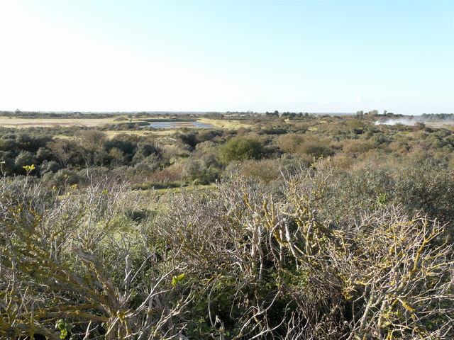
| Description |
English: Gibraltar Point National Nature Reserve This view from Mill Hill shows the Fenland lagoon with old saltmarsh to the left. The smoke is from the burning of brushwood. The bushes are a mixture of hawthorn, sea buckthorn, blackthorn and others. Brambles and hops are amongst the trailing plants growing through the bushes. |
| Date | |
| Source | From geograph.org.uk |
| Author | AlastairG |
| Attribution (required by the license) | AlastairG / Gibraltar Point National Nature Reserve / |
| Camera location | | View this and other nearby images on: OpenStreetMap |
|---|
_heading:292.00&language=en)
| Object location | | View this and other nearby images on: OpenStreetMap |
|---|
_heading:292.00&language=en)
Licensing

|
This image was taken from the Geograph project collection. See this photograph's page on the Geograph website for the photographer's contact details. The copyright on this image is owned by AlastairG and is licensed for reuse under the Creative Commons Attribution-ShareAlike 2.0 license.
|
This file is licensed under the Creative Commons Attribution-Share Alike 2.0 Generic license.
Attribution: AlastairG
- You are free:
- to share – to copy, distribute and transmit the work
- to remix – to adapt the work
- Under the following conditions:
- attribution – You must give appropriate credit, provide a link to the license, and indicate if changes were made. You may do so in any reasonable manner, but not in any way that suggests the licensor endorses you or your use.
- share alike – If you remix, transform, or build upon the material, you must distribute your contributions under the same or compatible license as the original.
File history
Click on a date/time to view the file as it appeared at that time.
| Date/Time | Thumbnail | Dimensions | User | Comment | |
|---|---|---|---|---|---|
| current | 14:17, 23 February 2011 | | 640 × 480 (113 KB) | GeographBot | == {{int:filedesc}} == {{Information |description={{en|1=Gibraltar Point National Nature Reserve This view from Mill Hill shows the Fenland lagoon with old saltmarsh to the left. The smoke is from the burning of brushwood. The bushes are a mixture of ha |
File usage
The following pages on the English Wikipedia use this file (pages on other projects are not listed):