Size of this preview: 536 × 599 pixels. Other resolutions: 215 × 240 pixels | 429 × 480 pixels | 687 × 768 pixels | 916 × 1,024 pixels | 1,832 × 2,048 pixels | 3,086 × 3,450 pixels.
Original file (3,086 × 3,450 pixels, file size: 1.5 MB, MIME type: image/png)
| This is a file from the Wikimedia Commons. Information from its description page there is shown below. Commons is a freely licensed media file repository. You can help. |
| Description |
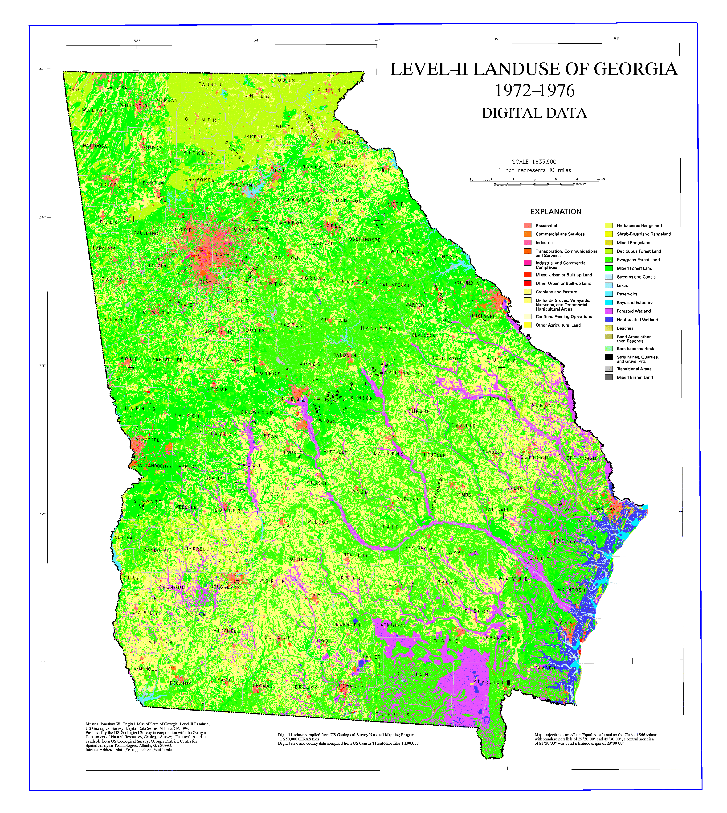
English: Map showing historical land use in Georgia (1972-1976). |
| Source | Source: USGS |
| Author | |
| Permission (Reusing this file) |
PD-USGOV-INTERIOR-USGS. |
Licensing
This image is in the public domain in the United States because it only contains materials that originally came from the United States Geological Survey, an agency of the United States Department of the Interior. For more information, see the official USGS copyright policy.
|
Wikipedia upload log
A Wikipedia description page is/was here. All following user names refer to en.wikipedia.
- 2006-10-24 21:44 Tlmclain 3086×3450× (1571588 bytes) Map showing historical land use in Georgia (1972-1976). Source: [http://csat.er.usgs.gov/statewide/layers/landuse2.html USGS] {{PD-USGov-Interior-USGS}} [[Category:Georgia (U.S. state) maps]]
File history
Click on a date/time to view the file as it appeared at that time.
| Date/Time | Thumbnail | Dimensions | User | Comment | |
|---|---|---|---|---|---|
| current | 20:50, 9 April 2009 | | 3,086 × 3,450 (1.5 MB) | File Upload Bot (Magnus Manske) | {{BotMoveToCommons|en.wikipedia|year={{subst:CURRENTYEAR}}|month={{subst:CURRENTMONTHNAME}}|day={{subst:CURRENTDAY}}}} {{Information |Description={{en|Map showing historical land use in Georgia (1972-1976). Source: [http://cs |
File usage
The following pages on the English Wikipedia use this file (pages on other projects are not listed):
Global file usage
The following other wikis use this file: