Size of this preview: 800 × 536 pixels. Other resolutions: 320 × 214 pixels | 640 × 429 pixels | 1,024 × 686 pixels | 1,280 × 857 pixels.
Original file (1,280 × 857 pixels, file size: 146 KB, MIME type: image/jpeg)
| This is a file from the Wikimedia Commons. Information from its description page there is shown below. Commons is a freely licensed media file repository. You can help. |
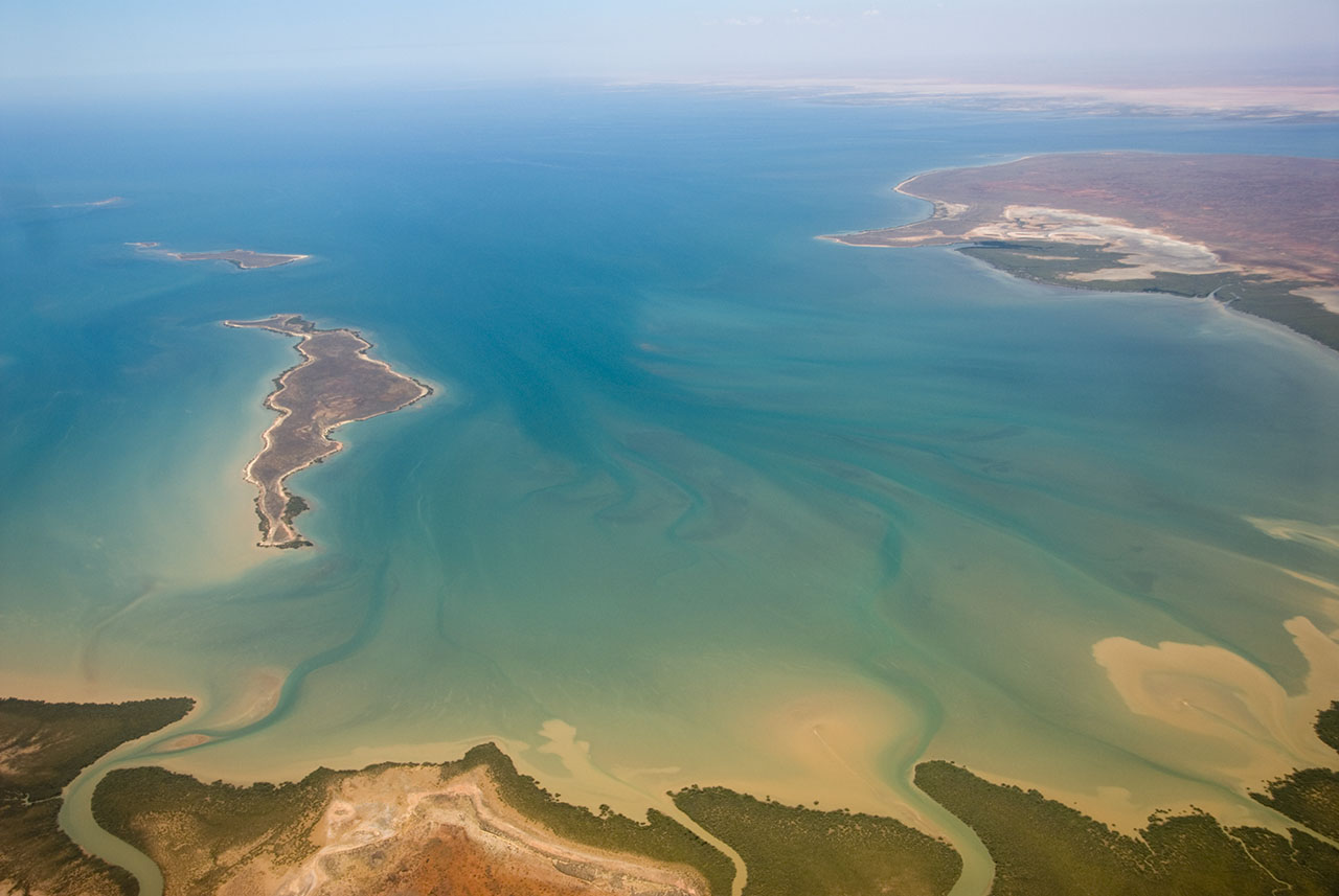
| Description | This is an aerial photograph of Gales Bay, a bay at the south end of Exmouth Gulf, Western Australia. The nearest foreground is Doole Island; behind it is Roberts Island; the further island is possibly Whitmore Island. The land on the right is the Sandalwood Peninsula. In the top right hand corner some of Giralia Bay can just be seen; across the top can be seen the continuing coastline of Western Australia. |
| Date | |
| Source | https://www.flickr.com/photos/61952179@N00/366312114/ |
| Author | Jon Hanson |
| Permission (Reusing this file) |
This file is licensed under the Creative Commons Attribution-Share Alike 2.0 Generic license.
|
| Camera location | | View this and other nearby images on: OpenStreetMap |
|---|
| This image, originally posted to Flickr, was reviewed on 18 May 2008 by the administrator or reviewer Kanonkas, who confirmed that it was available on Flickr under the stated license on that date. |
File history
Click on a date/time to view the file as it appeared at that time.
| Date/Time | Thumbnail | Dimensions | User | Comment | |
|---|---|---|---|---|---|
| current | 12:20, 18 May 2008 | | 1,280 × 857 (146 KB) | Hesperian | {{Information |Description=This is an aerial photograph of Gales Bay, a bay at the south end of Exmouth Gulf, Western Australia. The island in the foreground is Doole Island; behind it is Roberts Island; the further island is ''possibl |
File usage
The following pages on the English Wikipedia use this file (pages on other projects are not listed):
Global file usage
The following other wikis use this file:
- Usage on ar.wikipedia.org
- Usage on arz.wikipedia.org
- Usage on ceb.wikipedia.org
- Usage on de.wikipedia.org
- Usage on fi.wiktionary.org
- Usage on lt.wikipedia.org
- Usage on nl.wikipedia.org
- Usage on pnb.wikipedia.org
- Usage on ur.wikipedia.org
- Usage on www.wikidata.org