Size of this preview: 380 × 599 pixels. Other resolutions: 152 × 240 pixels | 305 × 480 pixels | 487 × 768 pixels | 650 × 1,024 pixels | 1,300 × 2,048 pixels | 2,715 × 4,277 pixels.
Original file (2,715 × 4,277 pixels, file size: 3.54 MB, MIME type: image/jpeg)
| This is a file from the Wikimedia Commons. Information from its description page there is shown below. Commons is a freely licensed media file repository. You can help. |
| Description |
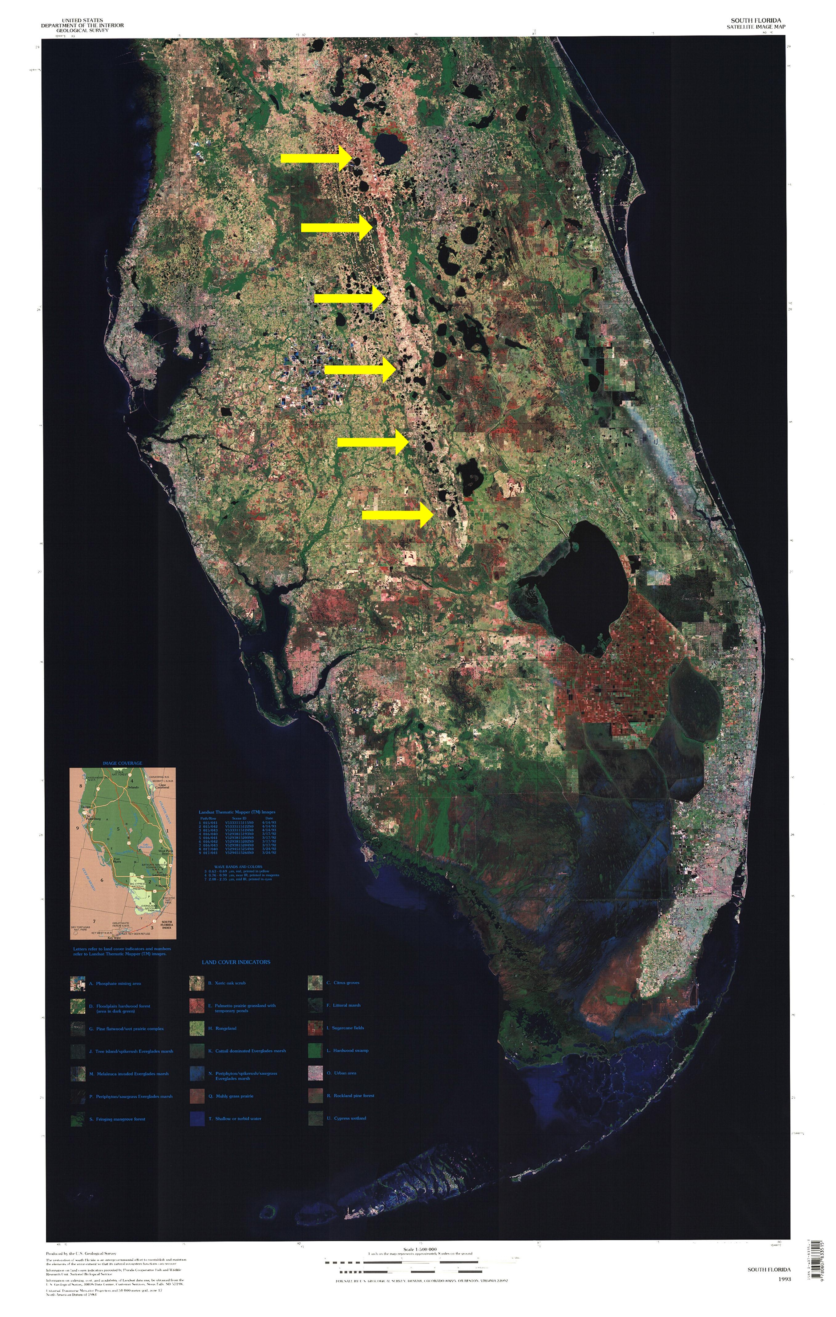
English: Satellite image of the Florida peninsula with yellow arrows indicating the position of the Lake Wales Ridge. |
| Date | |
| Source | South_Florida_Satellite_Image_Map.jpg |
| Author |
|
| This is a retouched picture, which means that it has been digitally altered from its original version. Modifications: Added arrows to highlight a feature (Lake Wales Ridge). The original can be viewed here: South Florida Satellite Image Map.jpg:
|
This image is in the public domain in the United States because it only contains materials that originally came from the United States Geological Survey, an agency of the United States Department of the Interior. For more information, see the official USGS copyright policy.
|
File history
Click on a date/time to view the file as it appeared at that time.
| Date/Time | Thumbnail | Dimensions | User | Comment | |
|---|---|---|---|---|---|
| current | 02:10, 8 December 2011 | | 2,715 × 4,277 (3.54 MB) | Lithium6ion | {{Information |Description ={{en|1=Satellite image of the Florida peninsula with yellow arrows indicating the position of the Lake Wakes Ridge.}} |Source =[[:File:South_Florida_Satellite_Image_Map.jpg|South_Florida_Sate |
File usage
The following pages on the English Wikipedia use this file (pages on other projects are not listed):