Size of this preview: 800 × 444 pixels. Other resolutions: 320 × 178 pixels | 640 × 355 pixels | 1,024 × 568 pixels | 1,415 × 785 pixels.
Original file (1,415 × 785 pixels, file size: 2.9 MB, MIME type: image/png)
| This is a file from the Wikimedia Commons. Information from its description page there is shown below. Commons is a freely licensed media file repository. You can help. |
Summary
| Description |
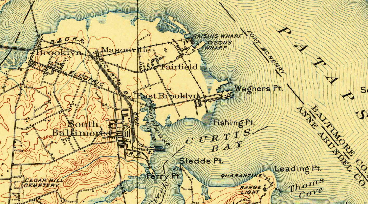
English: Map detail showing communities on or near the Fairfield Peninsula, from the January, 1907 USGS map centered on Relay, Maryland. Map shows Brooklyn, Masonville, Fairfield, Wagner's Point & South Baltimore (Curtis Bay). |
| Date | |
| Source | United States Geological Survey - https://store.usgs.gov/product/278194 |
| Author | United States Geological Survey |
| Other versions |
.png)
Licensing
This image is in the public domain in the United States because it only contains materials that originally came from the United States Geological Survey, an agency of the United States Department of the Interior. For more information, see the official USGS copyright policy.
|
File history
Click on a date/time to view the file as it appeared at that time.
| Date/Time | Thumbnail | Dimensions | User | Comment | |
|---|---|---|---|---|---|
| current | 00:57, 18 December 2019 | | 1,415 × 785 (2.9 MB) | Sauzer | User created page with UploadWizard |
File usage
The following pages on the English Wikipedia use this file (pages on other projects are not listed):