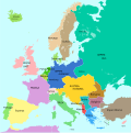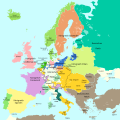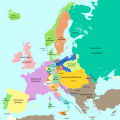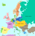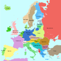
Size of this PNG preview of this SVG file: 600 × 600 pixels. Other resolutions: 240 × 240 pixels | 480 × 480 pixels | 768 × 768 pixels | 1,024 × 1,024 pixels | 2,048 × 2,048 pixels | 1,363 × 1,363 pixels.
Original file (SVG file, nominally 1,363 × 1,363 pixels, file size: 353 KB)
File history
Click on a date/time to view the file as it appeared at that time.
| Date/Time | Thumbnail | Dimensions | User | Comment | |
|---|---|---|---|---|---|
| current | 10:17, 15 September 2023 |  | 1,363 × 1,363 (353 KB) | Lalpino | File uploaded using svgtranslate tool (https://svgtranslate.toolforge.org/). Added translation for ca. |
| 15:09, 3 November 2016 |  | 1,363 × 1,363 (349 KB) | Furfur | Grenze zwischen Griechenland und Bulgarien korrigiert | |
| 10:31, 22 October 2016 |  | 1,363 × 1,363 (348 KB) | Furfur | Farbe von Norwegen und Schweden vertauscht, Bildgröße skaliert (Anpassung an andere Karten | |
| 11:37, 20 October 2016 |  | 931 × 917 (340 KB) | Furfur | Details | |
| 04:07, 2 October 2016 |  | 930 × 917 (340 KB) | Furfur | cleanup | |
| 17:30, 29 September 2016 |  | 930 × 917 (338 KB) | Furfur | letztes Detail | |
| 17:27, 29 September 2016 |  | 930 × 917 (338 KB) | Furfur | Schriften vergrößert | |
| 17:17, 29 September 2016 |  | 930 × 917 (338 KB) | Furfur | Detailkorrekturen | |
| 17:06, 29 September 2016 |  | 930 × 917 (344 KB) | Furfur | Meer ergänzt | |
| 16:54, 9 December 2014 |  | 928 × 914 (825 KB) | Furfur | bessere Farbe für Frankreich |
File usage
The following pages on the English Wikipedia use this file (pages on other projects are not listed):
Global file usage
The following other wikis use this file:
- Usage on ca.wikipedia.org
- Usage on de.wikipedia.org
- Usage on hu.wikipedia.org
- Usage on no.wikipedia.org
- Usage on pl.wikipedia.org
- Usage on rm.wikipedia.org
