Size of this preview: 785 × 600 pixels. Other resolutions: 314 × 240 pixels | 629 × 480 pixels | 1,006 × 768 pixels | 1,280 × 978 pixels | 2,560 × 1,955 pixels | 5,000 × 3,819 pixels.
Original file (5,000 × 3,819 pixels, file size: 1.28 MB, MIME type: image/png)
| This is a file from the Wikimedia Commons. Information from its description page there is shown below. Commons is a freely licensed media file repository. You can help. |
White background
Summary
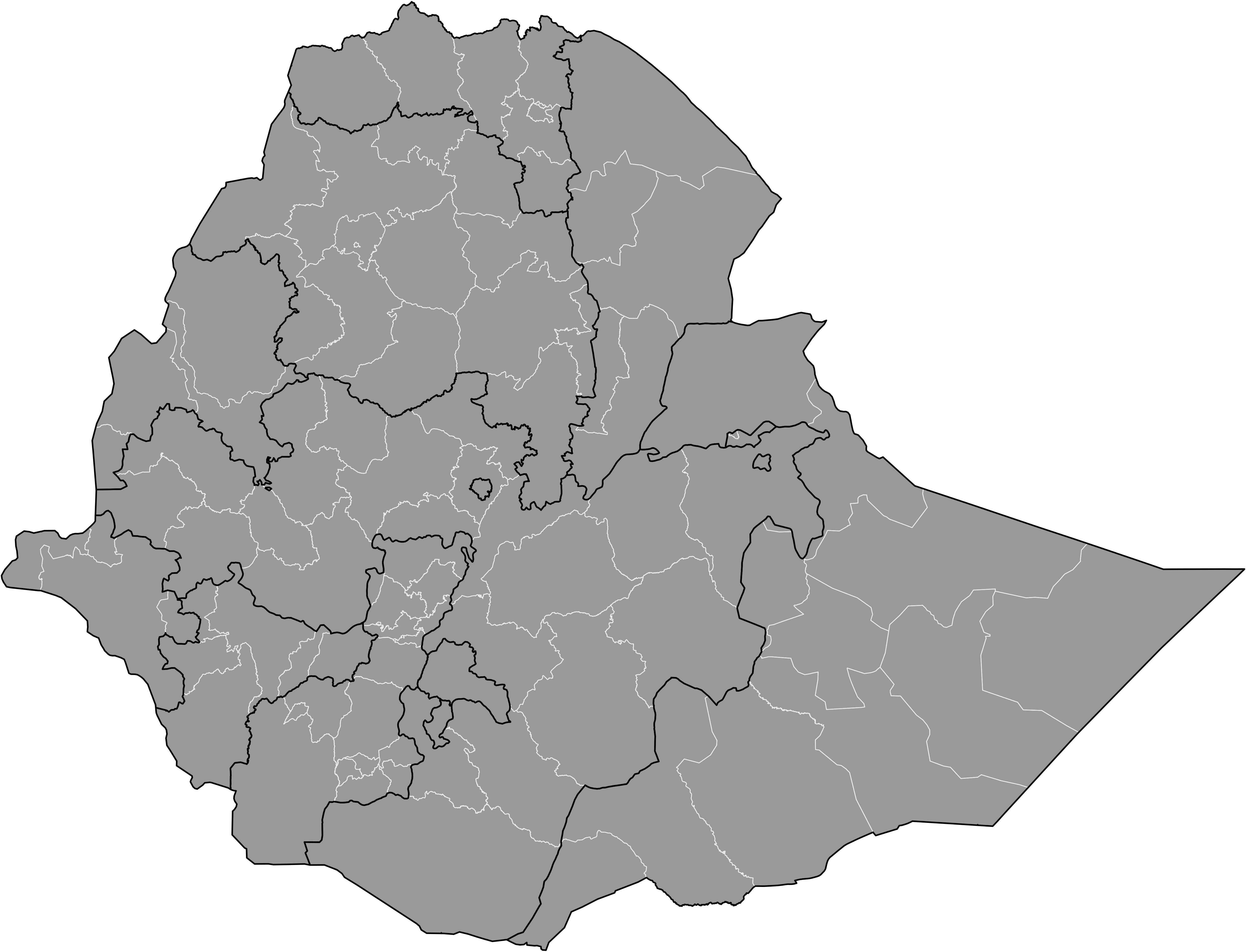
| Description | Map of the zones of Ethiopia. Created by Rarelibra 19:17, 11 April 2007 (UTC) for public domain use, using MapInfo Professional v8.5 and various mapping resources. |
| Date | 11 April 2007 (original upload date) |
| Source | No machine-readable source provided. Own work assumed (based on copyright claims). |
| Author | No machine-readable author provided. Rarelibra assumed (based on copyright claims). |
Licensing
| I, the copyright holder of this work, release this work into the public domain. This applies worldwide. In some countries this may not be legally possible; if so: I grant anyone the right to use this work for any purpose, without any conditions, unless such conditions are required by law. |
File history
Click on a date/time to view the file as it appeared at that time.
| Date/Time | Thumbnail | Dimensions | User | Comment | |
|---|---|---|---|---|---|
| current | 01:11, 21 March 2022 | | 5,000 × 3,819 (1.28 MB) | Ue3lman | update |
| 17:15, 9 April 2008 |  | 1,315 × 1,011 (65 KB) | Rarelibra | Remove lines | |
| 17:13, 9 April 2008 |  | 1,315 × 1,027 (65 KB) | Rarelibra | updated map style | |
| 19:17, 11 April 2007 |  | 1,281 × 878 (25 KB) | Rarelibra | Map of the zones of Ethiopia. Created by ~~~~ for public domain use, using MapInfo Professional v8.5 and various mapping resources. |
File usage
No pages on the English Wikipedia use this file (pages on other projects are not listed).